Monday, August 8, 2011

Hiking Hellhole Canyon to Maidenhair Falls Apr. 16th 2011

 A short hike from the hot, dry desert flat into a narrow canyon and to a hidden waterfall, full of mosses, vines, and trees, this tiny oasis felt like a world away. Hellhole Canyon is home to Maidenhair Falls, a seasonal 20-foot waterfall that makes a refreshing hiking destination on a hot day in the California desert.

The route in red is the one I took. The other in yellow is part of the California Riding & Hiking Trail. One I hope to do soon.

Looking back towards the trail head.

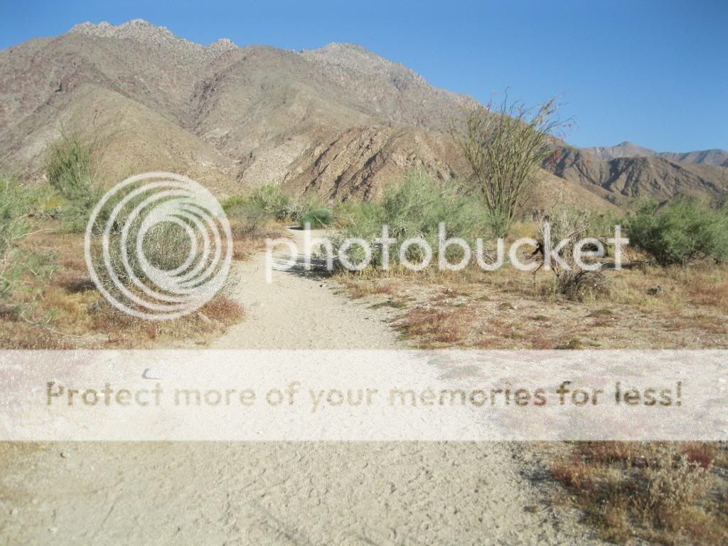
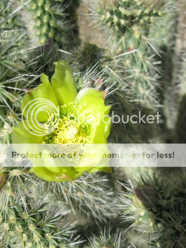
The trail begins out on the flat alluvial fan well outside the canyon containing typical California desert vegetation.

What's up with these rock stacks?
Looking back towards Borrego Springs.

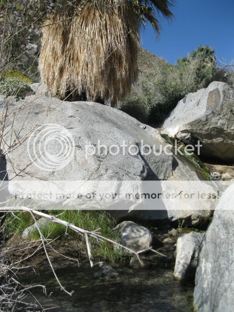
Deeper into the canyon the terrain gets rockier and vegetation starts closing in.
A nice spot to relax in the shade.
Once you reach the first set of palm trees, the trail gets a bit strenuous and the vegetation turns into jungle-like thickets of palms, sycamores, canyon grape, and those pesky catclaws.

Where do I go?
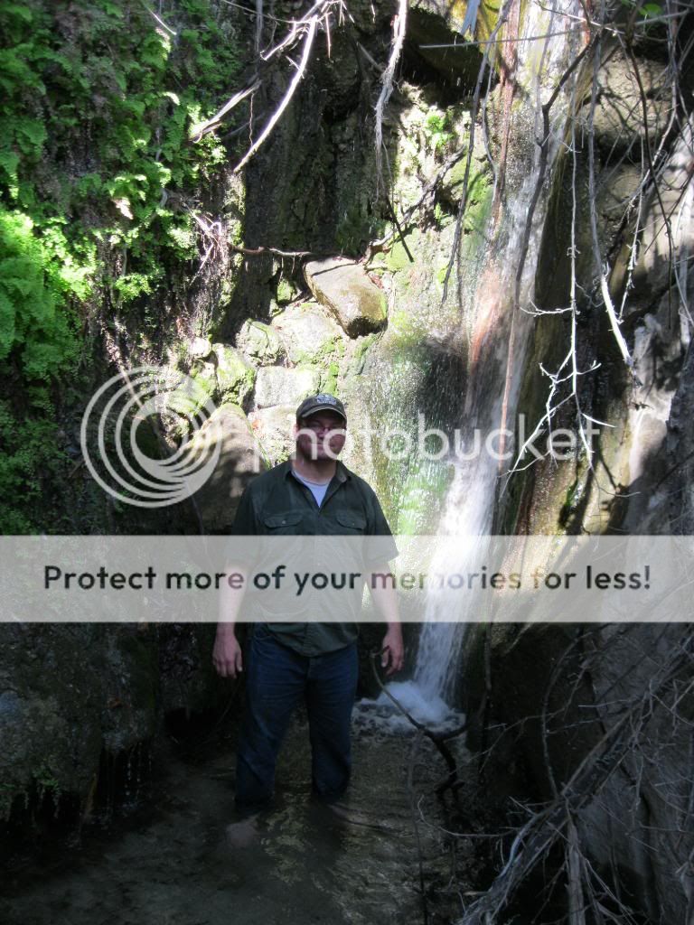
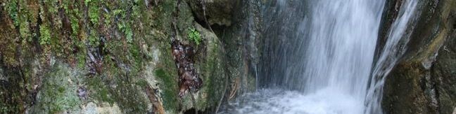
My destination, Maidenhair Falls.

As usual, pictures don't do it justice.


After a bit of relaxation, it was time to head back down.
By the time I reached the trail head it had warmed up considerably, making me glad I had packed enough water. I really enjoyed this hike and look forward to returning to this desert oasis.

Anza-Borrego Desert State Park: Sandstone Canyon Mar. 26th 2011

 (Photo by Steve - SSCPhoto.zenfolio.com)

It was a nice, if somewhat windy, day out in the desert. There was one particular canyon I had not been to in a few years. Since then, earthquakes had altered the route a bit. Sandstone Canyon has been called the most spectacular small wash in Anza-Borrego Desert State Park. Like a hidden jewel, this particular natural feature requires time and effort to find. The canyon walls, which feature horizontally stacked layers of tan and dark brown sandstone, soar to almost 200 feet in some places.

You are in the Split Mountain Fault Zone.
Split Mountain was formed by erosion along this fault line. Flood waters cut down through the layered rock, forming Fish Creek. During flash floods thousands of tons of debris tumble through Split Mountain, scouring out the deep gorge.

The gorge you see before you provides an exit for much of the rock that was formed in the Split Mountain Fault Zone over the past 20 million years. More than 40,000 acres of watershed is funneled through this canyon. From here the flood waters flow more than 20 miles towards the Salton Sea.

Note the countless layers of rocks. They have much to tell about the history of Split Mountain.

Split Mountain.

Fossilized reef.

You are now entering...

One of the canyon collapses from the earthquake.

Steve (SSC)


It was great having the terrain changed up a bit.
Winding our way through...


Lots of tight spots along the way.


Getting tougher...


End of the line.

Even from here I can tell its gonna be a cold drive on the way home.

On our way back out.
Having some fun along the way.

We then ran into about 20 Jeeps coming through.


Airing up just before hitting the road.
Its always a great time out in ABDSP, with so much to see and do. Looking forward to my next adventure out there.

Carveacre Road/Pancake Rock & La Posta Truck Trail Jan. 29th 2011


 On this day there was to be a bit of estrogen overload at my house from my wife's baby shower. It was with this in mind, my father-in-law, Mike and his uncle, Jerry and I decided to head out to a few trails close to home. Jerry has had his 2006 Jeep Rubicon for only a few months now and has been wanting me to show him around a few of the trails I'm familiar with. So far, he's only been in a few sandy washes around Anza-Borrego. Carveacre Road was to be the toughest trail he's been on.

Airing down along the road.
Starting up the trail. Notice the hikers on his tail. That's how slow he was going.


He was very impressed with his Jeep's ability.
The climb up Pancake Rock gave him a bit of pause.

Pictures don't do this climb justice.

At the top. A great place to relax, b.b.q., or just hang out.

Views out towards Lake Barrett.

Coming down...

A little fun on the "playground".

On the way down I let my father-in-law take the wheel.

"Is this old Jeep gonna hold together?"

Hopefully this trail stays unmaintained.

Afterward, we drove down the road a ways to La Posta Truck Trail.


This is an easy route and a blast in the snow.

The elevation here is 5400 ft. 


The Pacific Crest Trail crosses here.
What else awaits to be explored in the back country?

We soon finished up the trail and hit the highway towards home. It was a nice day spent on the trails. I enjoyed showing Jerry what his Jeep was capable of and look forward to seeing his confidence and experience grow with each new trail.