With Outdoor Adventure USA's 2013 BorregoFest event coming up, it was time to get out and check on the conditions of the trails. At 6am on Saturday, September 21st my good friend Ollie picked me up in El Cajon and soon we were headed east in his Toyota FJ Cruiser. Southern California's back country had experienced some major thunderstorms and flash flooding a few weeks ago so we were curious to see how this might have affected some of our local desert trails.
We made our way through the Laguna Mountains, past Lake Cuyamaca and fueled up in Julian before making our way down to the Oriflamme Canyon trail head in Banner.
This area is between Highway 78 in Banner and County S2 at the bottom of the grade from Box Canyon. Chariot Mountain is ringed by three trails. On the south is Mason Valley Truck Trail through Oriflamme Canyon. On the west is California Riding and Hiking Trail through Chariot Canyon and to the east is Rodriguez Spur Truck Trail through Rodriguez Canyon.
This route was known as the short cut through Julian to San Diego in the old days. In the mid-1800's the San Antonio and San Diego mail line, better known as the "Jackass Mail Line" traveled through Oriflamme Canyon to San Diego.
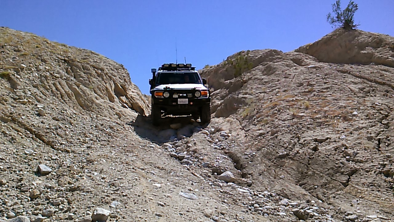
Making our way down Rodriguez Canyon, past Right Fender Ranch. We soon find that a few sections of the route ahead are washed out pretty good. Dropping a wheel into one of the many deep ruts we came across would leave one stranded without backup or a winch.
Our next stop was Blair Valley, which is situated between Granite Mountain and Whale Peak, accessible along County Road S-2 south of California Route 78. This region offers two-wheel drive accessibility, hiking trails, primitive camping, and cultural and natural history resources.
Blair Valley contains four established hiking trails: Marshal South Home, Pictographs, Morteros trails and a branch of the California Riding and Hiking Trail, which descendsfrom the Cuyamaca region and passes through Blair Valley on its way to the South HomeVisitor Center in Borrego Springs. This, the longest trail in the park, rises to nearly 5,000 feet and drops to below 1,000 feet in Borrego Valley, exhibiting a wide variety of different habitats.


Recreational vehicle campers enjoy the flat areas surrounding the Blair lake bed, while tent campers disperse farther out into the nearby Little Blair Valley. Afterward, we continued on to Vallecito Wash and Carrizo Creek. For thousands of years, the course of Vallecito Wash has been a refuge and trail for many native and immigrant Americans. Generations of Kumeyaay people camped along the springs here. The Mormon Battalion of 1847 passed here to join in the war between the Untied States and Mexico. This wash also follows a section of the 2,800 mile-long Butterfield Overland Stage route between St. Louis and San Francisco. The route operated from 1857 to 1861.
Carrizo Creek holds the location of the stagecoach station built for the Butterfield stage line that ran all the way from Missouri to San Francisco, starting in 1858. It looks like someone is working to restore the station or is just marking its location. Click the link below for more info on this historic site.
HISTORICAL AND ARCHAEOLOGICAL INVESTIGATIONS
OF THE CARRIZO CREEK STAGE STATION
Further travel east of the Carrizo Station will bring you to the Carrizo Impact Area, used by the United States Navy as an air-to-ground bombing range during World War II and the Korean War. It is in the Anza-Borrego Desert in southeast area and covers about 45 square miles. The range is closed to the public due to the hazard of unexploded ordnance. Bombs ranging from 3 to 1,000 pounds, rockets, 20-millimeter cartridges and 50-caliber bullets were dropped and fired on the range from 1942 until June 1959. After that, the range was only used a few times. The first clearance of material occurred during late 1959 and early 1960 and the second in January 1965. A large amount of unexploded bombs and wreckage were found. An inspection in 1970 found only detonated or non-explosive ordnance, but it took place in only one day. Additional unexploded ordnance has been found on a regular basis since then.

Clearing the area of bombs is made difficult by the large number of munitions and the fact that they burrowed up to 30 feet into the ground after being dropped from aircraft, although some have worked their way up to the surface through natural processes. Despite the area receiving the highest classification of hazard from unexploded ordnance, the area is considered low priority for cleanup because its remote location makes it unlikely that anyone (except maybe folks like me) will be hurt by it.
Exiting Carrizo Creek and back into Valliceto Wash, we turned north into the twisting canyon of Arroyo Seco del Diablo (Spanish for "Devil's Dry Wash). This area is part of the Carrizo Badlands, an ancient alluvial fan from the ancestral Colorado River, which emptied into the Gulf of California as a delta outlet. Arroyo Seco del Diablo has cut through the hardened sandstone concretions carried downstream from afar to create the deep-sided canyon this trail follows today.
To get to Fish Creek we would have to descend Diablo Drop Off and into a narrow canyon called Broken Shaft Gulch. The drop-off is made up of two descents with a break in the middle. The first drop is usually steep with loose sand and ruts but on this trip a found major damage from the recent rains. The second part, which is a narrow slot with large steps and wheel rut, wasn't really affected from the storms.
Shortly after descending the drop off and entering the gulch, I perched myself atop a ridge to get a few shots of Ollie's FJ making its way through a few rocky sections. As the vehicle started to climb a boulder it suddenly died. Ollie tried starting it again but to no avail. We were suddenly stranded in the desert.
When your broke down you might as well break out the beer! A couple of Jeeps ended up coming up the canyon from the opposite direction so it was nice to know we weren't totally alone out there. However, Ollie already had us in contact with our wives and some friends who could help us via HAM radio. After a few hours of troubleshooting we managed to find a little 20amp fuse for the electronic fuel injection that had blown. After replacing it the FJ started right up. We were saved! It was bittersweet finding such a simple fix to our situation.
Fish Creek on the eastern edge of the park south of California route 78, is an area of sparse vegetation and abundant wildlife. Some of the main attractions of the Fish Creek area are the beautiful twisting canyons, oddly shaped caves and raised fossil reefs. The sun was getting low as we made our way through this fascinating area and back towards the pavement of Split Mountain Road.
Cruising through Split Mountain puts drivers at the base of shear sandstone cliffs, rising perhaps a hundred feet or more from the dusty bed of Fish Creek. Split Mountain was formed by an ancestral stream that divided the Vallecito Mountains from the Fish Creek Mountains. Geology students and park visitors from all over the world come to study it and enjoy its rugged, awe-inspiring beauty.
Soon this truly adventurous day came to a close. Unfortunately, vehicle problems prevented us from covering as much ground as we wanted too, but its all part of the experience of exploring the back county. So its always good to be prepared. We had enough water and food to stay with the rig for awhile or bug out if needed; we also had a way to communicate with others. With more than 600,000 acres, Anza-Borrego Desert State Park has countless areas that one can explore. I'll be looking forward to getting out here again in October for
OAUSA's 2013 BorregoFest event.