Tuesday, August 20, 2013

Island Rendezvous & Meet n Greet, Fiesta Island, San Diego

Several online 4X4 & adventure forums held an annual Meet and Greet together in San Diego, CA on August 17, 2013.  It was a day of family fun right on the beach on Fiesta Island in Mission Bay.  It was an all day affair where you could park your vehicle on the sand and enjoy a relaxing day of beach fun, fishing, swimming, boating,or just hanging with friends. There was also testing for Amateur Radio licenses of all levels. For more information, check out the sites below-

American Adventurist

Outdoor Adventure USA

Expedition Portal


Tuesday, July 16, 2013

Border Field State Park


At the southwestern most point of the continental United States is a California state park named Border Field State Park. The park is located within the city limits of Imperial Beach in San Diego County, adjacent to the suburb of Playas de Tijuana in Mexico. The Tijuana River National Estuarine Research Reserve contains much of Border Field State Park and is an important wildlife habitat. The salt and freshwater marshes give refuge to migrating waterfowl and resident wading birds.


The park offers hiking, horse trails, surfing and birding. In recent years this area has been through many changes and seen much controversy. For some time it seemed that this park would become a victim of The War On Terror. Fortunately, it was announced earlier this year that the public will continue to be able to access Friendship Park, the historic meeting place overlooking the Pacific Ocean on the U.S.-Mexico border.

After the Mexican-American War ended in 1848, the Treaty of Guadalupe-Hidalgo required a new 2,000-mile border between the two nations. Surveying work began in October 1849 on an elevated mesa at the Tijuana River Estuary's southwest corner. A 15-foot obelisk and monument were built to mark the site, and "Monument Mesa," with an elevation of approximately 50 feet, became a tourist destination, with more than 100,000 visiting the monument in 1888, after a railroad connection was completed between San Diego and Tijuana. Though the monument marked the start of the border, it has the number 258 etched into its marble because all boundary markers along the border were numbered beginning in Texas and going westward.


The mesa and surrounding area were dedicated as a California state park in August 1971, and the monument became a national historic landmark in September 1974. The U.S. Border Patrol has a special detail of agents who come and open the gates in Friendship Park to allow the public to go into the locked area between what they call the primary and secondary fences to visit the monument, on the mesa above the beach, between 10am and 2pm on weekends.


Three concrete bunkers, constructed in 1942 as part of the U.S. military's coastal defense system during World War II, sit atop Bunker Hill in Border Field State Park. Until 2008, when fencing construction began, the abandoned bunkers could be accessed by hikers in the state park but are now are off limits to the public. The bunkers, built into the ocean side of the hill east of the park's Monument Mesa, were manned until 1945 by U.S. soldiers who scanned the Pacific horizon through telescopes for Japanese ships and submarines. The bunkers have metal ladders at the top that extend approximately two stories down, where soldiers slept on metal bunks. The bunkers were part of a larger Army and Navy operation at Border Field that included 35 buildings, a barracks and a machine-gun range.


An ironic aspect of this area is that on the South side of the fence there is nothing to keep you from enjoying the beach all the way up to the fence that borders between two countries. Swim in the water, approach the border fence, or just have some fun in the sun, as many families were doing. While in the “Land of the Free” there are multiple fences, surveillance, and armed federal agents on SUV's and ATV's. If you come within 50 feet or so of the actual border fence a border patrol agent will drive down to you and tell you to keep back. There is also a secondary fence the runs about 50 parallel feet north of the actual border, that ends about 200 feet of east of the pacific ocean. The federal government took this strip of land away from the state and marks the limit of American citizen access.


Heading west on Monument Road, you will eventually arrive at the entrance to Border Field State Park at 1500 Monument Road, which is what you see below, with the Pacific Ocean exactly 1 mile to the west, directly behind the sign. The gates here are closed when the paved road that leads to the beach area of the park is flooded. On weekdays or after heavy rains, this is where you’ll drop off your car to roam the area, as long as it’s during the operating hours of the park.


From these bluffs, you can look down at the Tijuana Estuary. These wetlands were once part of a broad, deep water lagoon, teeming with fish and shellfish. Good fishing was a huge draw for ancient peoples making this area one of the first to be settled in San Diego.


Enjoying the beach and the sights across the border is really only half the fun. Finding and navigating through Border Field State Park are adventures in and of themselves.


Border Field State Park is fun and relaxing place to visit. I don't think there's another beach in Southern California where I could look in either direction along the coast and not see another soul. For some interesting historical aspects, check out the border area. Don’t go within 40 feet of the actual border and the border patrol agents should ignore you. For a more relaxing, natural atmosphere, head north. Be sure to bring a bicycle, picnic, binoculars, or a day pack and hiking shoes and enjoy your time at Border Field State Park.

Visit the California Department of Parks and Recreation site for more information on Border Field State Park.

Tuesday, May 28, 2013

Calipatria River Monsters


Most fisherman head west to the ocean to fish this time of year. I head in the opposite direction. The deserts of Imperial Valley with its network of canals and rivers offers some of the best freshwater fishing anywhere in Southern California. Taking advantage of the long Memorial Day weekend, I loaded my gear into my Jeep and headed out Monday afternoon. 

Billed as the "lowest-down city in the Western Hemisphere" because it lies 184 feet below sea level, Calipatria is famous for its standard that floats a flag at the exact level of the Pacific Ocean.


The nearby Alamo River, which flows from Baja California, across Imperial Valley to drain into the Salton Sea, is an area I frequently fish. It was formed in 1905 along with the New River and modern Salton Sea when the Colorado River flooded and broke through several levees. It took two years to control the Colorado River's inflow to the Imperial Valley. In most places, the river is a vegetation-choked ravine with a small watercourse at the bottom. However, there are areas where the river widens and clear areas along its bank allows access for fishermen.

Finding a spot to catch bait along one of the many irrigation canals.

Flathead catfish hunt the shallows at night in search of sunfish. I thought five bluegill would be enough bait to get me through the night. I was wrong.

These roads would be impassable in wet weather. Some sections require 4wheel drive even in normal conditions.

Drive around long enough and you'll come across some sketchy-looking areas.

Checking out some new areas along the Alamo River.

Many sections had a straight five foot drop to the water, which would have made fishing alone somewhat difficult.

The "road" to get here was so soft and silty that at times I was worried about getting stuck, even with 4WD.

A little ways out of town, I settled on a spot with easier shore access.

Looking upriver.

Rods out and waiting for a bite, when suddenly...

...a little beaver comes swimming downriver in front of me.

It felt much nicer out once the sun started going down.


Soon my patience was rewarded when the line began peeling of one of my reels and I landed this seven pound flathead catfish.


Soon after releasing this fish to fight another day and sending out another bait, my line took off again. I engaged the reel and held on for dear life. Whatever was one the end of my line was much stronger than the previous fish. For what seemed like an eternity, I fought to keep the fish on my line and out of the snags. Every time I got him him in close, he would take off again into deeper water. I had the drag on my reel set fairly high with 30lb line. It didn't seem to matter. I finally started making progress and just as I got into position to land this fish with net in hand, the rod snapped back and hit me as all pressure on the other end of the line was now gone. I reeled in to check the gear to see what might have happened. The hook was gone. The fish probably snapped the line on some underwater snag. It was heartbreaking. I was hoping to break my personnel best of 15 pounds, but it wasn't happening tonight. 

I ended up getting two more runs that night but wasn't able to make them stick. This was the first time I had run out of bait while fishing there. I usually fish until 4AM or until the bait is gone. Next time, get more bait! It was a little after midnight when I headed out and I got home around 2:30AM. Even when you lose good fish, its always a good time getting out and wetting a line. Looking forward to next time! 

Tuesday, May 14, 2013

Sheep & Lower Coyote Canyon Trip, ABDSP


One of my favorite areas to camp and explore in the Anza-Borrego Desert State Park is Sheep and Lower Coyote Canyons, located North West of the town of Borrego Springs, CA. Being somewhat secluded and accessible only with 4 wheel drive (besides foot or on horseback), its usually easy to escape the crowds here. 

The original goal was to camp up in Sheep Canyon with my family, hike to some of the nearby streams and waterfalls, and generally just relax and soak in the beautiful desert landscape. Unfortunately my wife ended up having too much school work to finish up, so I ended up heading out alone on this trip. However, I was able to spend some time with my girls at Dos Picos Park in Ramona, CA before I headed out to brave the desert heat.


Audrey was able to entertain herself with an umbrella while mommy was busy with a photo shoot.


There was also a nice playground she enjoyed.


After a few hours we said our goodbyes and I headed off towards the desert.

There are always great views coming down Montezuma Grade.


A few of the roadside plaques you can checkout while taking in the views.


My tires eventually left the pavement behind where I found a spot to air down and get ready for the ride up through Lower Coyote Canyon.


The trail up Lower Coyote Canyon  travels up the canyon wash, passing close to a campsite of the second Juan Buatista de Anza expedition in 1775. Hand-dug wells produced enough water for nearly 800 head of stock and more than 200 people.

The expedition, from Tubac in what was then Sonora, Mexico (now part of Arizona) would take five and a half months to reach Alta California. Juan Bautista de Anza first passed through the Borrego Valley in March 1774, on his first route-finding mission to the new Spanish settlements in California. Santa Catarina Springs was their campsite on March 14, 1774.


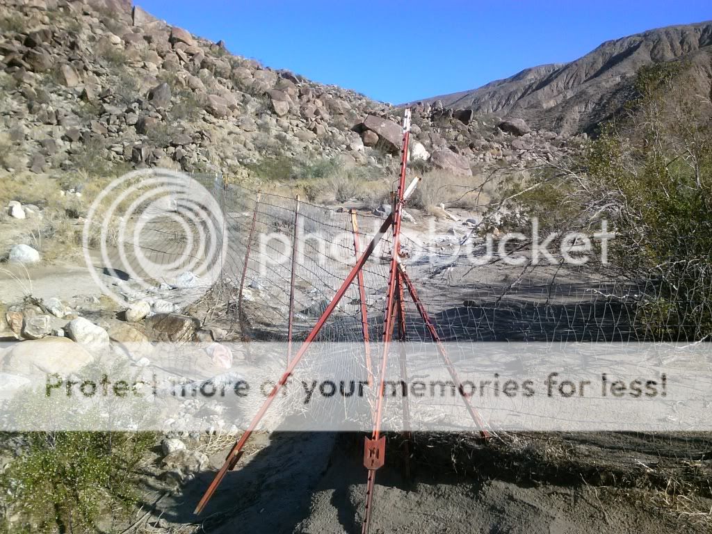
Coyote Canyon runs from Anza to Borrego Springs and offers two separate vehicle trails, one from the north and one from the south. Of the two, the southern approach is more popular with hikers and four-wheelers. For eight months of the year, hikers, horses, and mountain bikers can connect the two trails via a 3-mile section of the canyon between Middle and Upper Willows. Between June 1 and September 30 each year, Coyote Canyon is closed to all users to protect water sources for the rare peninsular bighorn sheep. A seasonal closure gate after Second Crossing restricts users during this time.

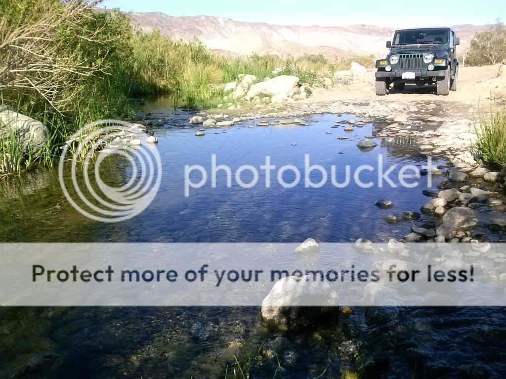
The trail leaves from Borrego Springs to the north, passing the historical marker commemorating Sebastian Tarabal. It passes the graded road to Vern Whitaker Horse Camp before leaving the citrus groves behind and entering Anza-Borrego Desert State Park up a formed, sandy trail. There are three crossings of Coyote Creek; the first is usually dry, the others normally have year-round water that may be up to 24 inches deep.


Checking out the second crossing of Coyote Creek. The exact location of the crossing can change from time to time with each passing storm.


The third crossing of Coyote Creek has been re-routed just upstream. You can see the large boulders blocking the old entrance to the left.

There are people who would like to see this area closed to all motorized use. This may have been done to appease the "environmentalist". 

Approaching the new third crossing.

This was still the deepest crossing, with water reaching to just under the door.

The difficult stretch of trail comes a short distance after Third Crossing. The trail ascends a steep, rocky pinch that consists of loose, fist-size rocks and large embedded boulders. Careful wheel placement is needed to keep the undercarriage off the rocks. Approaching "Boulder Alley" I shift the 4WD into low range and work my way up the rocks, being careful to avoid any contact with the undercarriage. 

This was the first time taking my 2000 TJ Jeep Wrangler up this trail. With no suspension lift on 31 inch BFG A/T's I was able to traverse this section of trail without any issues.

 Once at the saddle, looking north into Collins Valley, the difficult part of the trail is over, although you do have to return the way you came. The trail reverts to a smooth, sandy surface as it descends into Collins Valley.

At this point in the trail I always get a sense of how remote this area is. Adventure awaits!

This should remind us to tread lightly and to pack it in, pack it out.

This monument commemorates the site of Santa Catarina, named by Juan Bautista de Anza when his expedition camped here on March 14th, 1774.

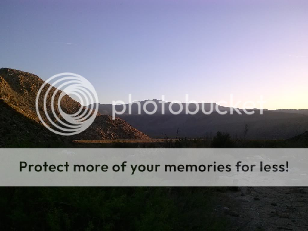
Overview of Santa Catarina and Lower Willows.


Looking north towards Toro Peak and Santa Rosa Mountains.

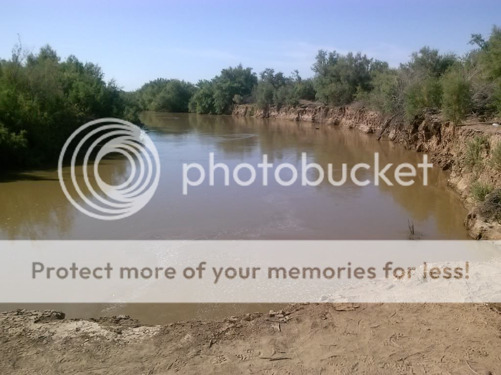
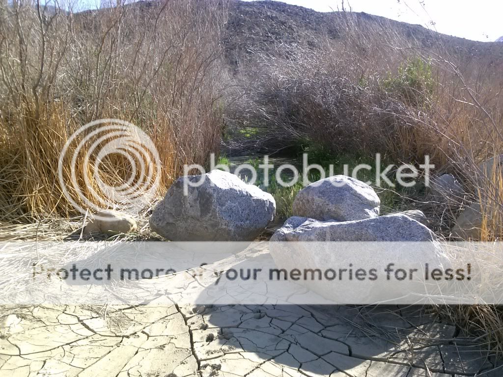
Sheep Canyon Wash crossing. Only once have I ever seen water flowing down this far.

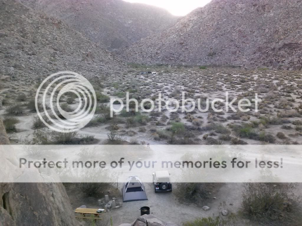
Arriving at the camping area I was surprised to see new signs. There are five improved sites with new fire rings and wooden picnic tables. Only $10.00 a night.

One of the new sites.
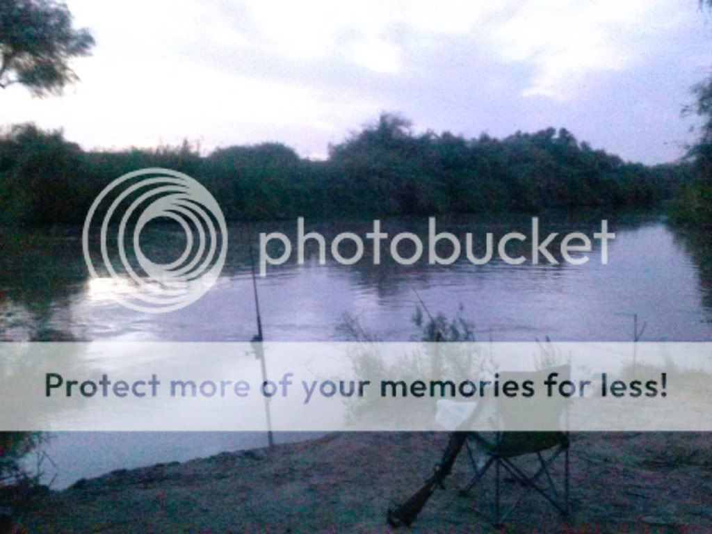
Home for the night.

Looking out towards Collins Valley.

Looking back up Sheep Canyon.

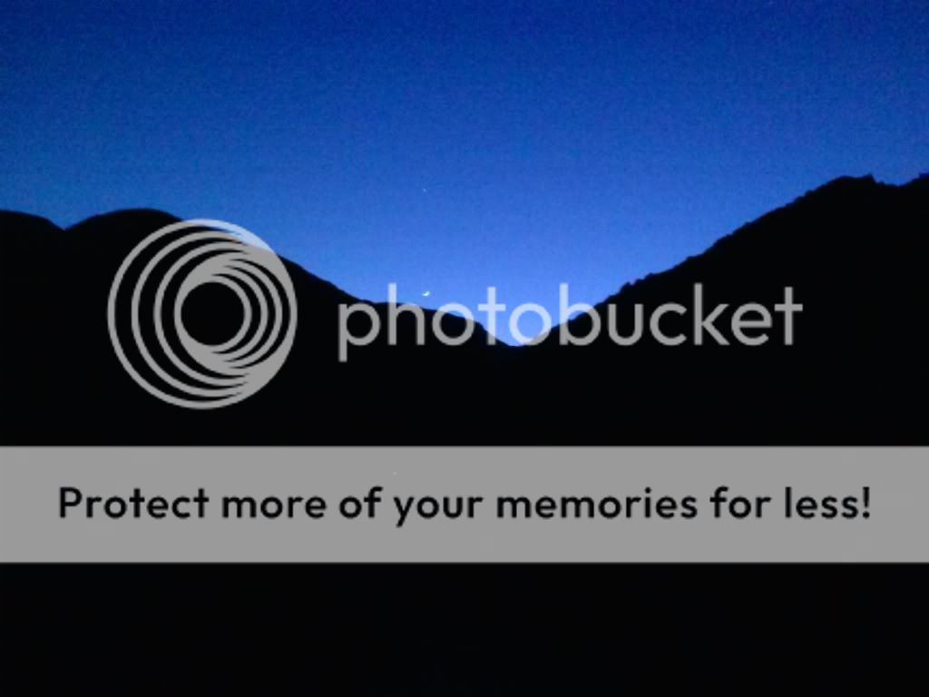
I was treated to a night of shooting stars and satellites crisscrossing the sky. 

The next morning I was up early for a hike into Cougar Canyon.

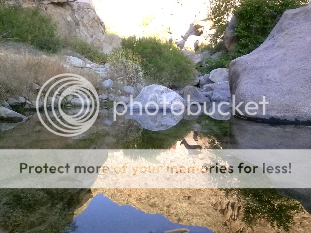
I was hoping to avoid the head of the day and reach a few pools and waterfalls located deep within the canyon.


A nice spot to camp if you're backpacking in.

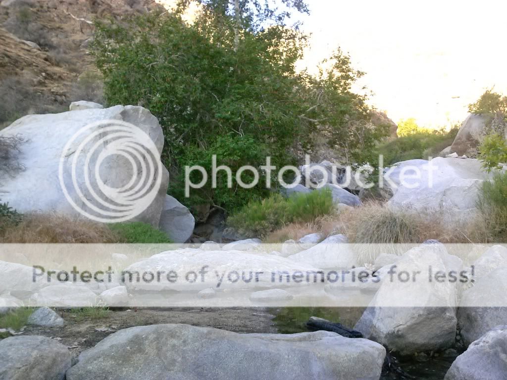
I finally find water!


Continuing up the canyon...

Here is Jerry Schad's description of this hike: "Anza-Borrego's Cougar Canyon is a place where new worlds open up at every turn. There are more gorgeous sights to see along a half-mile of this canyon than in a full day's hiking in most other parts of our local desert. Ahead (as far as your scrambling skills will carry you) you'll discover limpid pools, silvery waterfalls, feathery cascades of spray, a pocket palm grove, and on one rock a fading psychedelic "eye" -- circa 1970 rock art."

My goal was to reach a deep pool fed by a large waterfall at the 2300-feet elevation mark.

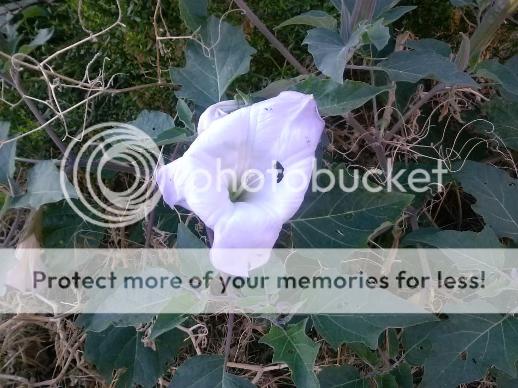
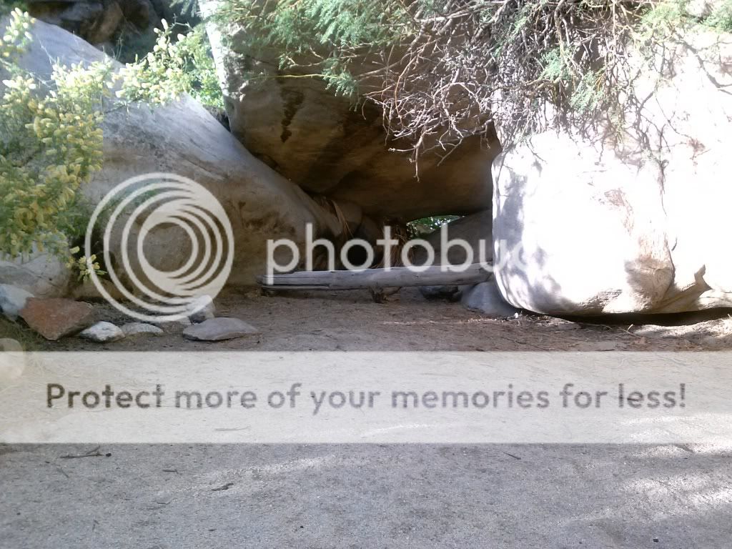
I came across a cave with what looked like a pictograph nearby.

If those markings are authentic, its really irresponsible that some would build a fire so close. Besides that, ground fires are not even allowed in the state park.

Returning to my Jeep at the trail head. I wasn't able to head as far into the canyon as I had hoped. Since it was getting hotter, the route getting more technical, and I was alone, I went as far as I felt comfortable. I'd rather have folks read this trip report than an article about a missing hiker!

Heading out towards the middle of the canyon and the 3 mile section that was closed off in 1996. Lovin' the two tracks out here.

I would have liked to have driven this whole trail back in the day.

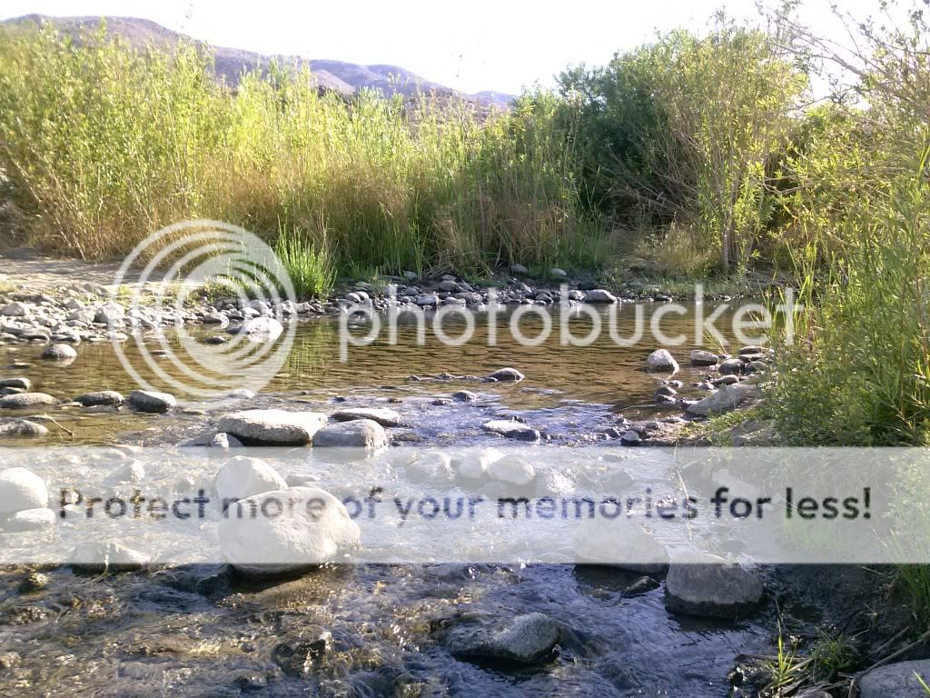
Checking out the path that leads through Lower Willows in Coyote Canyon.


Getting ready to descend the the rock gardens and leave Collins Valley behind.

Passing the desert gardens area.

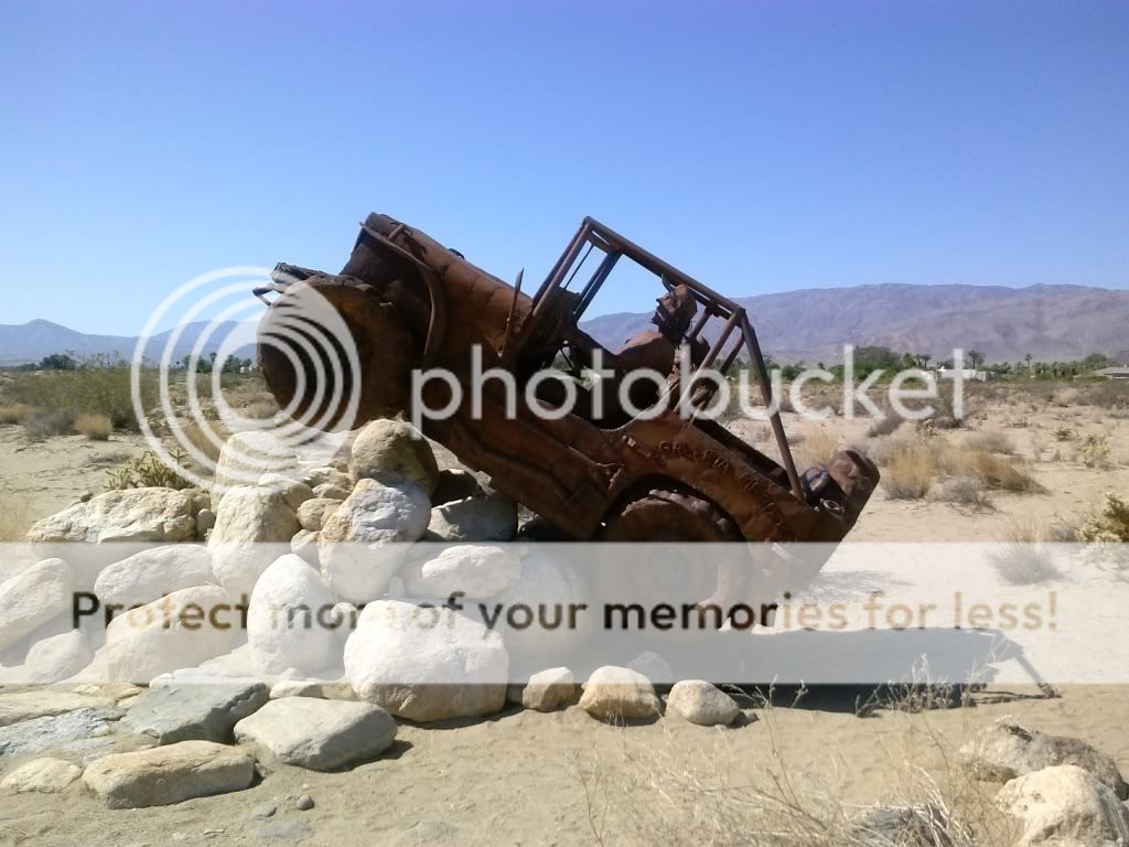
Once off the trail I stopped to check out a few of the many metal sculptures around town, built by Ricardo A. Breceda.

This was Fray Pedro Font who served as chaplain and “cosmographer” on the the second famed trek of the  Anza expedition.


A plaque in honor of those who traversed this land.

Here there be dragons.


For more information about these metal sculptures click here: http://ricardoabreceda.com/

All too soon it was time to make the trek back into civilization. I avoided the highways as much as I could and stuck to the back roads.

Passing Lake Henshaw.

Black Canyon bridge, built in 1903. I've crossed over this many times over the years but its now closed.

There is now a new bridge built to preserve the old one.

Often, there's not much point to these trips other than to unwind and escape the hustle and bustle of everyday life. Exploring interesting areas that have some history to them is also a great bonus. Driving home I thought about my trip, the spectacular views and landscapes, and what I did to make myself slightly burnt, bug-bit, tired, and sore. It brought a smile to my face, and I was looking forward to seeing my beautiful wife and daughter at home.

Until next time, thanks for reading.