Showing posts with label trestle. Show all posts

Sunday, March 16, 2014

Banker's Hill, San Diego


"With two steep ravines spanned by quaint footbridges, scores of well-kept, historically significant homes, and mature landscaping, Banker’s Hill is a monument to the elegance of the past. The work of early-century architects Irving Gill, William Hebbard, Richard Requa, and Frank Mead is represented throughout the area. Much can be seen on the following 1.5-mile walk, which begins on Spruce Street at First or Second Avenue, just west of Balboa Park" - Jerry Schad 


There is quite the list in my mind of hikes and places I've been wanting to explore. Often my thoughts turn to the quintessential resource on hiking San Diego County- the late Jerry Schad's Foot & Afield in San Diego County. With an afternoon to spend with my family the weekend before our trip out to the Desert Rendezvous, I was quick to pick from my list Banker's Hill; an easy stroll close to home that my three year old daughter and five month pregnant wife would enjoy, right into the urban core of San Diego. Some of the older neighborhoods of San Diego, west of Balboa Park and north of downtown, afford some of the best historic walks found in the city. This stroll features two historic, hidden gems- a wood-trestle footbridge crossing one canyon and a suspension footbridge spanning another canyon.

Here's a bit of Wikipedia on the area: "Bankers Hill, sometimes known as Park West, is a long established uptown San Diego neighborhood near Balboa Park. It is bordered to the north by Hillcrest (at Upas St.), to the south, past Date Street, by Downtown (at Interstate 5, the San Diego Freeway), to the east by Balboa Park, and the west by Interstate 5, Little Italy and the neighborhood known as Midtown.

The area is primarily residential south of Laurel Street and west of 5th Avenue. Many new construction projects are ongoing as of 2009, creating condominiums along 6th Avenue facing the park. Locations further west allow an elevated, panoramic view of Downtown, San Diego Bay, the airport, Coronado, Harbor Island and Mount Soledad. Many homes date from the late 19th century, including some which have been restored as offices or bed-and-breakfast inns. Architects Irving Gill, William Hebbard, Richard Requa, and Frank Mead designed homes in this area. The area acquired the name "Bankers Hill" because of its reputation as a home for the affluent."

After a tasty lunch at Phil's BBQ in Santee, we headed west on Interstate 8 then south on SR-163 to the 6th Street exit where we continued south, then west on Spruce Street. We parked at 2nd and Spruce to begin our city walk. 


Walking east on Spruce Street. Past Third Avenue, on the right, is a low building designed by William Hebbard in 1913 and stylized after the long-gone San Diego Cable Railway powerhouse. The cable-car line went into operation in 1889, carrying passengers from downtown through Hillcrest to a park on Adams Avenue.

South on 4th Avenue.

We caught sight of some of the recent severe storm damage suffered by this Southern California city.

Built in 1905, the Quince Street pedestrian bridge links Bankers Hill to Balboa Park over Maple Canyon. At 236 feet long and 60 feet tall, its one of few remaining wooden trestle pedestrian bridges in San Diego. Orignially built for $805, the bridge was meant to connect pedestrians with the Fourth Avenue trolley. 

This bridge reminds me of one of my favorite things about San Diego- its urban canyons. Tucked into corners around our fair city, one can find many beautiful canyons that are mini refuges from the busy streets and built-up neighborhoods above.

Ridden with termites and wood rot, the bridge was nearly slated for demolition in the 1980's when it was shut down. It was reopened in 1990 after a significant $250,000  overhaul. Approximately 30% of the original wood remains. On Sunday, March 20th, 2011 the west side of the footbridge took a direct hit from a falling eucalyptus tree during a storm. It was repaired and reopened six months later.

Two babies on board this pretty lady!

Heading north on 2nd Avenue reveals some classic revival styles.


The residence here at 136 Redwood is one of the earliest (1898) results of a partnership between William Hebbard and Irving Gill. The camphor tree on the corner is one of the largest in San Diego.


A left on Redwood to First brings you opposite Irving Gill’s Bishop’s Day School (1908), now the Self-Realization Fellowship.

Time for a short water break in the shade.

Now heading north on First, then left on Spruce, heading west to walk across the suspension footbridge.

I remember my grandfather showing me the Spruce Street suspension bridge years ago. The only bridge of its type in San Diego County, this 375 foot steel suspension bridge is anchored to massive concrete piers hidden beneath the soil at both ends. As you start crossing, you realize the bridge actually bounces, then sways as you continue walking. It's a little scary, and way cool. Perhaps the best-known “secret” in the neighborhood. 

This old bridge is loved by a large cross-section of San Diegans as well as tourists from around the world. Please preserve the peacefulness and serenity of the setting. FYI: the footbridge is monitored 24-hours and is closed from 10pm-6am.


I noticed quite a few love locks placed on the cables here. A love lock or love padlock is a padlock which couples lock to a bridge, fence, gate, or similar public fixture to symbolize their love. 

 Once on surface streets again, we turn left on Brant Street, a dead end. The house at the end (3100 Brant) was designed by Hebbard in 1907 after his partnership with Gill ended, but retains some of Gill’s influence.

At the southeast corner of Spruce and Curlew, is a 1914 design by Requa and Frank Mead influenced by Mediterranean and North African imagery.


At the southeast corner of Curlew and Thorn, is an interesting Palladian-style mansion dating from 1927. To poke fun at passersby, the plaque here reads...


Zigzaging east on Thorn, north on Brant, east on Upas, and north on Albatross, we come to some of the Gill “canyon houses,” dating from 1912–13 and designed to blend harmoniously with the natural landscape.


Around the corner, at the west end of Walnut Avenue, is a seemingly out-of-place Queen Anne Victorian house. Built in 1892 at Fourth and Walnut, it was moved to this site in 1911.


To conclude our walk, we headed east on Walnut to Second and then south back to our starting point. 


It may not be our usual back country getaway, but exploring San Diego’s Banker’s Hill neighborhood, using city streets and historic footbridges with my family was a fun and easy way to spend the afternoon. I'll have to check out the canyons around here on another day trip sometime. 

Saturday, December 7, 2013

Goat Canyon Trestle Hike, Nov. 2013


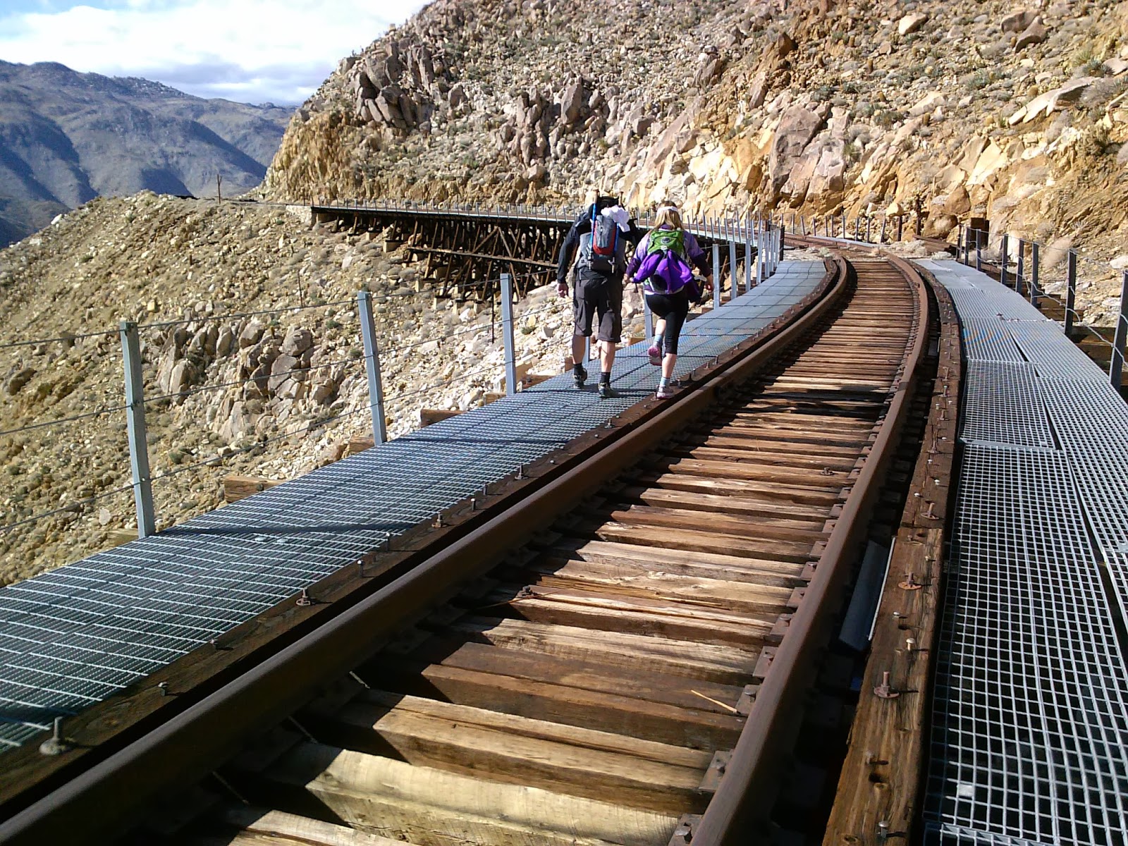
It looks like this has turned out to be my annual November hike. The Goat Canyon Trestle is an engineering marvel on the “impossible” San Diego and Arizona Railway that was constructed between 1907 and 1919 along the rugged Carrizo Gorge. The world's largest wooden trestle was built in 1932 after an earthquake destroyed one of the tunnels, forcing the railroad engineers to bridge Goat Canyon. This spectacular trestle remains to this day for adventure minded people to find deep within a rugged wilderness.  

For more history on this railroad, check out the link below.

San Diego's "Impossible Railroad"

For my last trip report here, check out this link: Goat Canyon Trestle Hike - November 2012

Those familiar with San Diego County know that it is full of great hikes, as it has an incredible amount of geographical diversity. There are hikes along the beach, foothills, mountains and deserts; all within about a two hour drive or less.  Many of these amazing hikes are worth experiencing, but to me they do not have the sense of adventure that the Goat Canyon Trestle hike has, making it one of my favorites. If you are not prepared for a strenuous hike that involves rough terrain, scrambling over boulders, maneuvering up and down dry waterfalls, and substantial elevation gains, this is not the hike for you. It involves a bit of off-highway driving to a somewhat remote trail head and spending a whole day to hiking out and back. First timers should consider bringing and using a map and compass, or GPS unit. Be sure to bring plenty of water, food, first-aid kit, and be prepared for the desert.

 Riding along with with my friend Steve and his girlfriend Tammy, we make our way along Mortero Wash to Dos Cabezas Road along a portion of railroad tracks to drop off a vehicle at our ending point.


Ominous looking clouds in the distance.


Starting out at Mortero Palms trail head.

There's plenty of rock scrambling to be had early on in this hike.

Steve, posing at this rocky overhang.

Hey, I gotta get in on this too.

Looking back at our progress so far.

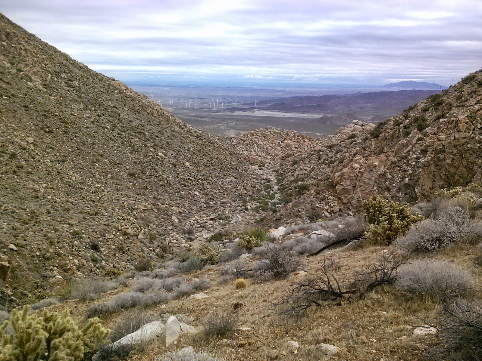
There's still a lot of climbing to do. From here you can see the wind farm just West of the town of Ocotillo.

Which line to take up the rocks? The one that won't break my neck!

Making progress through the boulder strewn pass.

Soon we come upon Mortero Palms oasis.


On a warm day these palms make for a relaxing break from the sun and heat.


Just past the palms we had to ascend up this narrow, smooth, dry waterfall.


Once at the top we had a great view of the palms and desert below.

The route ahead still has a few boulders to negotiate.


Time for a short snack break.


  Continuing on...

If you look closely at the large boulder in the center of the photo you'll notice a Yoni (female fertility symbol, or "Yoni" petroglyph) carved in the center by ancient Native Americans.


Once at the top of the first ridge we descend down into a canyon before climbing up the next ridge.

Watch your footing here and beware the cholla.


 Views out to the desert as we continue climbing.

Still climbing...

Here's the highest point along the hike. Its all downhill from here.


The upper reaches of Goat Canyon have a few dry waterfalls that need to be negotiated or bypassed.

Our first glimpse of the "Seven Sisters" railroad trestles along Carrizo Gorge in the distance.

At last, Goat Canyon Trestle comes into view.

There are still a few treacherous descents ahead of us.

Looking back up the way we came down.

 I made it!


After a lunch break and exploring the area for a bit it was time to continue on our way to the old railroad workers camp.

A group of motorcyclist passed by in one of the tunnels.


Carrizo Creek snakes its way through the gorge below.


I figured it was about time I climb down these derailed box cars...

...without falling off the mountain!


  Just before reaching this tunnel we turn right onto an old road and explore remnants of the construction camps the helped build the railroad.


Site of the railroad workers camp, built from discarded back powder cans during the construction of the railroad. (See my 2012 trip report for this hike to see an earlier photo of this site.)


From here we decided to look for the Blue Sun Cave near Indian Hill.

While traveling cross-country we came upon many areas that had pottery shards strewn about.

Archaeologists tell us that this area has been inhabited as far back as 6,000 years ago by the Kumeyaay and their ancestors.

Of course, left them to let other adventure minded folk find them again.

Native American grinding holes, or morteros.


Indian Hill is a a large rock pile of decomposing granite boulders that lends itself to numerous rock caves and shelters. The Blue Sun Cave gets its name from a blue sun pictograph in side it, along with many others.

We never found the cave. I think we were too far north and after doing some more research, I have a better understanding of were it might be. So that'll be an adventure for another day.

And so our trip comes to an end. Hiking out to Goat Canyon Trestle is truly an epic one-day adventure that I look forward to each year.