Sunday, December 8, 2013

Colorado River Trip 2013 Thanksgiving Weekend


Its a family tradition. We spend the long Thanksgiving weekend on Ferguson Lake, along California side of the Colorado River in Imperial County. For a bit of history for this area, check out one of my previous trip reports here: Colorado River Trip, April 2013

There's quite a bit to do around here and I usually try to do a bit of everything; fishing, hunting, hiking, off-roading, and boating. We had four days off work so on Thursday morning we loaded up the Jeep and headed East to catch up with our other family members who had left a bit earlier. Once out past the mountains and into the desert we caught up with my parents and sister's family, each towing their jet boats. I sure miss the little aluminum fishing boat I had. One of these days I'll get another one.

Upon reaching the CA/AZ state line, we fueled up our vehicles and then made our way to Squaw Lake, were the boats would then make their way upriver to our cabin while the vehicles took the dirt road in.

While passing through El Centro, this large structure shows that we're actually below sea level.  

Finally catching up to our folks. I may need to remind them about the 55 mph limit while towing...

Launching the boats at Squaw Lake.


Information about this area can be found here: Squaw Lake Campground


Ferguson Lake Road (EC 800) is usually passable for just about any vehicle, but can become nearly impassable after heavy rainfall.


There were a few muddy spots along the road that didn't cause too much trouble.

 Arriving at the Imperial Valley Hunting & Fishing Club, or "Gun Club" as we call it.


The next four days we're spent relaxing and fishing. I managed to catch a few striped bass that ended up being deep fried and delicious.


.

I always love watching the sunrise over the lake while enjoying some coffee.


Much of our time was spent hanging out on one of the large sandbars, downriver.

Hanging out with family and friends.

Loaded up and heading back towards civilization.


Crossing the Ocean to Ocean Bridge, which was a critical link in joining the Atlantic to Pacific Oceans with the highway. The bridge was built across the Colorado River between Yuma, Arizona and Fort Yuma, California in 1914 for $76,000 and dedicated during a citywide celebration May 22-23, 1915. At the time of its opening, the bridge provided the first safe, economical crossing of the river at Yuma and it was the only vehicle bridge across the Colorado River for 1,200 miles.

Making our way home Sunday afternoon. It was time well spent with family and friends, and as always I look forward to our next trip to the river.

Saturday, December 7, 2013

Goat Canyon Trestle Hike, Nov. 2013


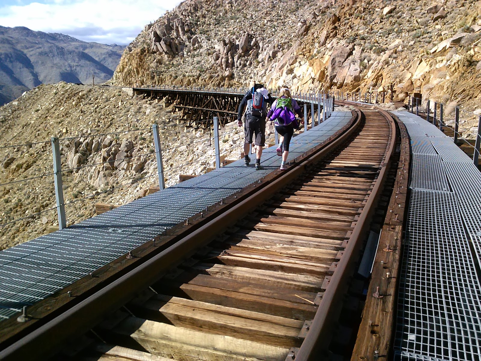
It looks like this has turned out to be my annual November hike. The Goat Canyon Trestle is an engineering marvel on the “impossible” San Diego and Arizona Railway that was constructed between 1907 and 1919 along the rugged Carrizo Gorge. The world's largest wooden trestle was built in 1932 after an earthquake destroyed one of the tunnels, forcing the railroad engineers to bridge Goat Canyon. This spectacular trestle remains to this day for adventure minded people to find deep within a rugged wilderness.  

For more history on this railroad, check out the link below.

San Diego's "Impossible Railroad"

For my last trip report here, check out this link: Goat Canyon Trestle Hike - November 2012

Those familiar with San Diego County know that it is full of great hikes, as it has an incredible amount of geographical diversity. There are hikes along the beach, foothills, mountains and deserts; all within about a two hour drive or less.  Many of these amazing hikes are worth experiencing, but to me they do not have the sense of adventure that the Goat Canyon Trestle hike has, making it one of my favorites. If you are not prepared for a strenuous hike that involves rough terrain, scrambling over boulders, maneuvering up and down dry waterfalls, and substantial elevation gains, this is not the hike for you. It involves a bit of off-highway driving to a somewhat remote trail head and spending a whole day to hiking out and back. First timers should consider bringing and using a map and compass, or GPS unit. Be sure to bring plenty of water, food, first-aid kit, and be prepared for the desert.

 Riding along with with my friend Steve and his girlfriend Tammy, we make our way along Mortero Wash to Dos Cabezas Road along a portion of railroad tracks to drop off a vehicle at our ending point.


Ominous looking clouds in the distance.


Starting out at Mortero Palms trail head.

There's plenty of rock scrambling to be had early on in this hike.

Steve, posing at this rocky overhang.

Hey, I gotta get in on this too.

Looking back at our progress so far.

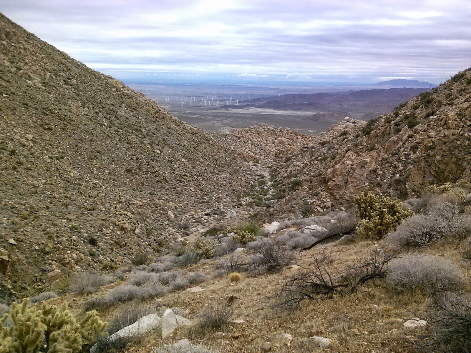
There's still a lot of climbing to do. From here you can see the wind farm just West of the town of Ocotillo.

Which line to take up the rocks? The one that won't break my neck!

Making progress through the boulder strewn pass.

Soon we come upon Mortero Palms oasis.


On a warm day these palms make for a relaxing break from the sun and heat.


Just past the palms we had to ascend up this narrow, smooth, dry waterfall.


Once at the top we had a great view of the palms and desert below.

The route ahead still has a few boulders to negotiate.


Time for a short snack break.


  Continuing on...

If you look closely at the large boulder in the center of the photo you'll notice a Yoni (female fertility symbol, or "Yoni" petroglyph) carved in the center by ancient Native Americans.


Once at the top of the first ridge we descend down into a canyon before climbing up the next ridge.

Watch your footing here and beware the cholla.


 Views out to the desert as we continue climbing.

Still climbing...

Here's the highest point along the hike. Its all downhill from here.


The upper reaches of Goat Canyon have a few dry waterfalls that need to be negotiated or bypassed.

Our first glimpse of the "Seven Sisters" railroad trestles along Carrizo Gorge in the distance.

At last, Goat Canyon Trestle comes into view.

There are still a few treacherous descents ahead of us.

Looking back up the way we came down.

 I made it!


After a lunch break and exploring the area for a bit it was time to continue on our way to the old railroad workers camp.

A group of motorcyclist passed by in one of the tunnels.


Carrizo Creek snakes its way through the gorge below.


I figured it was about time I climb down these derailed box cars...

...without falling off the mountain!


  Just before reaching this tunnel we turn right onto an old road and explore remnants of the construction camps the helped build the railroad.


Site of the railroad workers camp, built from discarded back powder cans during the construction of the railroad. (See my 2012 trip report for this hike to see an earlier photo of this site.)


From here we decided to look for the Blue Sun Cave near Indian Hill.

While traveling cross-country we came upon many areas that had pottery shards strewn about.

Archaeologists tell us that this area has been inhabited as far back as 6,000 years ago by the Kumeyaay and their ancestors.

Of course, left them to let other adventure minded folk find them again.

Native American grinding holes, or morteros.


Indian Hill is a a large rock pile of decomposing granite boulders that lends itself to numerous rock caves and shelters. The Blue Sun Cave gets its name from a blue sun pictograph in side it, along with many others.

We never found the cave. I think we were too far north and after doing some more research, I have a better understanding of were it might be. So that'll be an adventure for another day.

And so our trip comes to an end. Hiking out to Goat Canyon Trestle is truly an epic one-day adventure that I look forward to each year.