[I really am new to this whole blogging thing. I'm not even sure I'm set on the name here. Anyway, my main reason for starting this is to keep track of (and share) all my outdoor adventures, rather than having to search through various forums for my trip reports. So I'm gonna try to keep this updated as much as I can.]
I work nights, usually from 4pm to 12:30am. So when I have plans for the next day that start early I may or may not get any sleep. On Tuesday September 28th, 2010 I had plans to be ready to head out to Anza-Borrego at 5am with Ollie for a prerun for one of the routes he'll be leading for an event put on by Outdoor Adventure USA. http://www.oausa.net/content/2010-borrego-fest-signup-and-roster
So with about three hours of sleep to get me through the rest of the long day that awaited me, I climbed aboard Ollie's FJ Cruiser looking forward to some time spent in the desert.
In Alpine we pick up another passenger, Paul, a coworker of Ollie's. Soon we arrive in Julian to meet up with Dave in his H2 Hummer and Sean in his Toyota FJ Cruiser. During the warmer months I prefer to ride along with a group in the desert rather than dealing with the heat in my open air Jeep. The next one will definitely have a/c.
For the first part of out trip we head past the small mountain town of Julian, down Banner Grade on hwy 78 to the Chariot and Rodriguez Canyon trail head. Following Dave takes us to the Right Fender Ranch where we get to check out some old mining equipment. Dave leads a mine tour during this event in the Oriflamme and Rodriguez Canyon areas that is exclusive to us and is limited on the amount who can attend. He actually has permission to take folks into these mines and, on a few of them, get the history and information about the mines from the owners themselves. It's quite an opportunity.
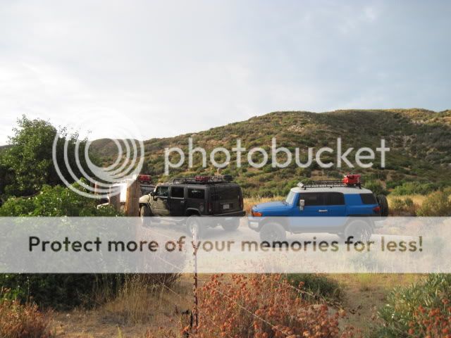
Parked at the entrance of the Right Fender Ranch.
Heading out to check on some old mining equipment.


I think I'm starting to wake up a bit now.

Stuff from 1896.

If you wander around here without permission, you're likely to get a shotgun stuck in your face...


Intersection of Rodriguez Canyon and Pacific Crest Hiking Trail.

Sean had a bit of a problem with one of his gas cans.

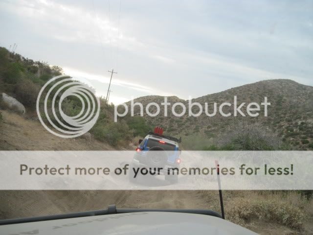
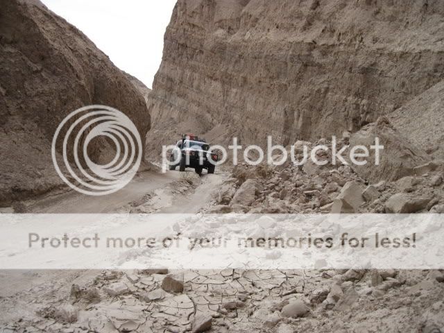
Looks like the trail is a little rutted out.
Lots of vegetation through this section of Oriflamme Canyon Trail.

After exploring the ranch for a bit, we continue on down Rodriguez Canyon, through a few rocky areas. Reaching the bottom on the canyon we make a sharp right up another trail to Oriflamme Canyon, which takes us back to where we started in Banner. Dave parts ways with us and we head on down the highway to the S2 and reach the campsite that will host the BorregoFest event. Its under new management and has undergone a few improvements. After checking in with the owner we hit the road again and soon find the entrance to Canyon Sin Nombre. From here we actually run the route backwards to Vallecito Creek Wash, Arroyo Seco Del Diablo Canyon and into Fish Creek/Split Mountain, along the railroad tracks skirting Fish Mountain (now on BLM managed land), under a trestle and into Carrizo Wash. A designated wilderness area (hate those) and closed bombing range pushes us onto a long trail with some gnarly whoop-tee-doo's. This is probably one of the most remote areas of the Anza-Borrego/Yuha Desert. You are alone out here.
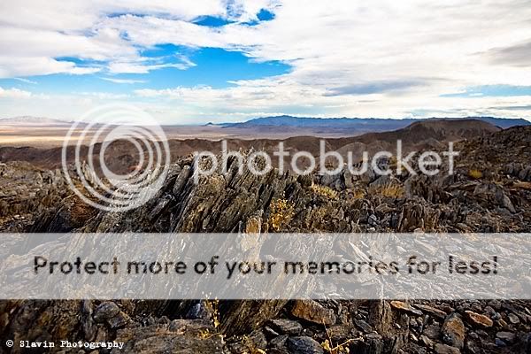
Eventually we pick up the trail that takes us up the backside of Carrizo Mountain. This area contains some of my favorite network of trails. The old mining roads can be narrow, rocky, and steep. The views from the summit provide great sights into Mexico, the Yuha Desert, Superstition Mountains, Salton Sea, and other surrounding areas.
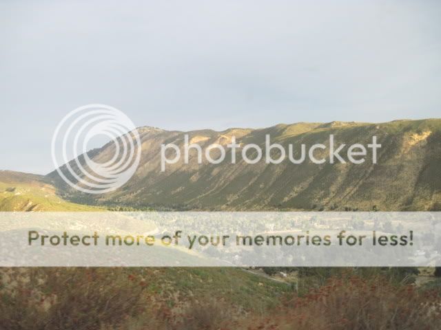
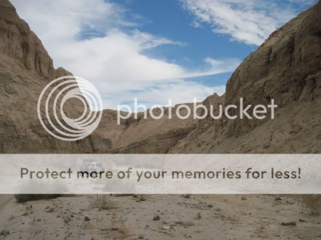
View of the Carrizo Badlands from the entrance of Canyon Sin Nombre off Hwy S2.

The varied geology in Canyon Sin Nombre gives good insight into the folding and faulting layers in the Carrizo Badlands.

We come across many partially collapsed canyon walls along the way.
Always camp well away from the canyon walls.

Arroyo Seco Del Diablo Canyon.
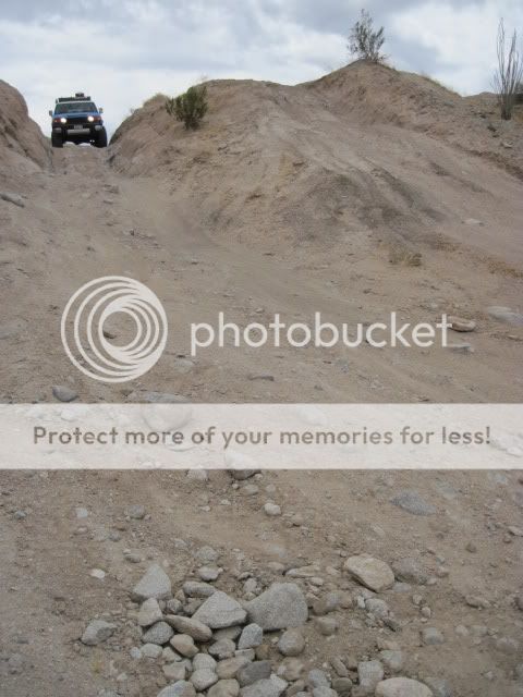
Coming down Diablo Drop-off.


Time for lunch!

Another collapse in Fish Creek Wash.

At this point in our trip the batteries in my camera died. Fortunately, I have photos from Ollie and Sean to share here as well.
Here are a few pictures from Ollie.


(From top to bottom: Diablo Drop-off, Fish Creek Wind Caves, Carrizo Wash railroad bridge, and near the summit of Carrizo Mountain)
Sean was also gracious enough to share the outstanding pictures he took along our trip (and to let me ride shotgun for awhile).


(From top to bottom: Sunrise over Laguna Mountains, Right Fender Ranch, Arroyo Seco Del Diablo Canyon, Highway S2, Anza-Borrego Desert, Split Mountain, and near the top of Carrizo Mountain.)
All and all, it turned out to be a great day out in out local deserts, even though I was only a passenger. With the recent record temperatures we've been experiencing around town (115 degrees!), it was actually cooler in the desert. But not cool enough for me to take the Jeep out. I'll give it a few more weeks. I still need to get out and prerun one more area for the upcoming BorregoFest event in October. Not sure if I'll be able to get any hunting in before then but I'll just have to see how everything plays out. October is going to be a busy month!


