We discovered new trails, explored old legends, and marveled at the history of the land and its people.

(This well was visited by Juan Bautista de Anza and his settlers to quench their thirst after traveling for two days without fresh water. Throughout history, this site has been the favored water stop for travelers of the Yuha Desert.)
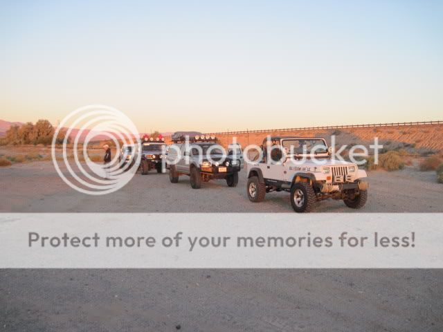
The Yuha Desert of extreme Southern California is rich in both human and natural history. The area contains several unique attractions; the Juan Bautista de Anza National Historic Trail, geoglyphs created by Native Americans, an area of rare crucifixion thorns, oyster shell beds, and the Yuha Well. The Yuha Desert is an Area of Critical Environmental Concern and is a limited use area. Routes traverse a variety of terrain, from flat desert pavement to sandy washes, to mud hills and other badlands type features. This was the area I was planning to explore in preparation for my upcoming Sunday run during OAUSA's 2010 BorregoFest, so around 6am Saturday, October 9th, I was on the road with Ralphie, Willie, and Derek after meeting them in Alpine.
There are also a few well-known legends and stories associated with this area. Perhaps the most interesting of these is the Lost Ship of the Desert or Pearls. In the second half of the nineteenth century, thousands of migrants crossed the Colorado Desert of Southern California. Some survivors of this journey arrived with a story of a strange sighting- a Spanish galleon resting upright upon the sands of the great desert. Implausible as it sounds that there might be the wreck of an ocean-going ship 100 miles or more inland from either the Pacific or the Gulf of California, the story has persisted for centuries in reports from Indian peoples, Spanish explorers, prospectors, migrants and treasure hunters.


There are also a few well-known legends and stories associated with this area. Perhaps the most interesting of these is the Lost Ship of the Desert or Pearls. In the second half of the nineteenth century, thousands of migrants crossed the Colorado Desert of Southern California. Some survivors of this journey arrived with a story of a strange sighting- a Spanish galleon resting upright upon the sands of the great desert. Implausible as it sounds that there might be the wreck of an ocean-going ship 100 miles or more inland from either the Pacific or the Gulf of California, the story has persisted for centuries in reports from Indian peoples, Spanish explorers, prospectors, migrants and treasure hunters.
The winds of the desert are constantly changing the arid landscape, which is probably the reason that no expedition has ever successfully located the lost vessel. Perhaps one day a back country explorer will stumble across the decaying ship and claim its fortune.

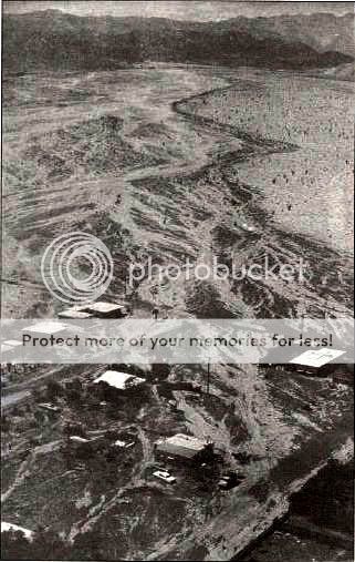
Geographical context of the Salton Sea compared to ancient Lake Cahuilla.

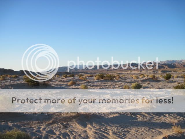
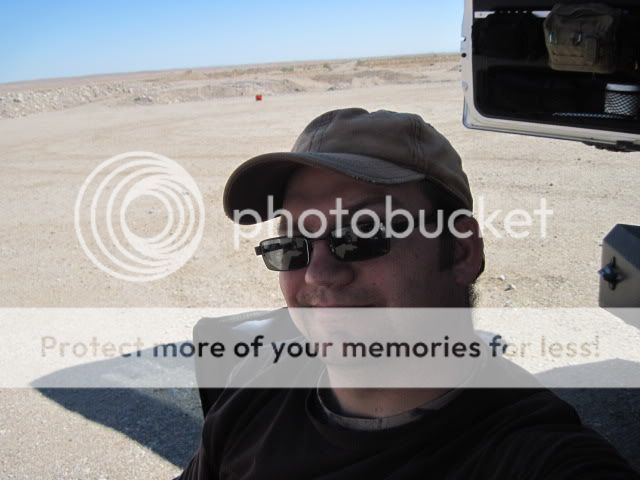
Watching the sun rise just south of the desert town of Ocotillo.

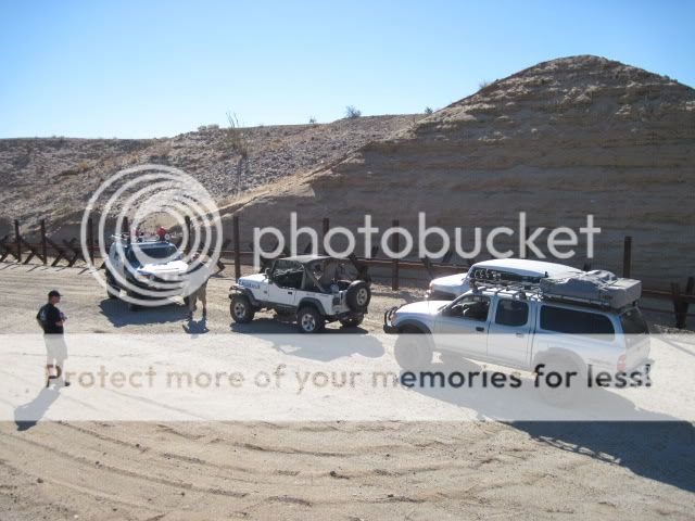
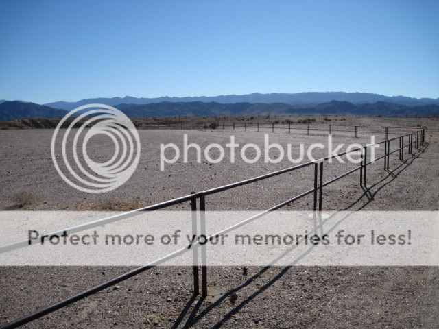
After airing down and a brief drivers meeting we we're ready to hit the trails.
Since all the routes within the Yuha Desert are marked and numbered I was able to print out map off the BLM's website. Our route through the area is highlighted here:

The National Historic trail of Juan Bautista de Anza also crosses through this region. The particular section of the National Historic Trail shown below extends from Yuma Crossing on the California-Arizona border, down into Mexico, and back up through western Imperial County lands, managed by the BLM, and into Anza-Borrego Desert State Park.

Stretching from Nogales, Arizona to the Presidio of San Francisco, the Juan Bautista de Anza National Historic Trail commemorates the journey made by de Anza in 1775 and 1776 to establish a new, secure route from Sonora up into Alta California . Competition between Russian, English, and Spanish colonizers for control of California made it necessary for the Spanish to find a new road with which to connect the missions to each other, and to people and supplies in Mexico. Used by the military, the Church, and by civilians, the trail secured Spain’s foothold in California. The Yuha Desert is home to a twenty mile stretch of the Juan Bautista de Anza National Historic Trail. In the winter of 1775, Anza led 300 men, women and children across the Yuha on their way to San Francisco. Through freezing temperatures and blinding snow, the group struggled forward and succeeded. Today, visitors travel the historic route in the Yuha to get a feel for what the expedition entailed, passing by the Yuha Well and several prehistoric geoglyphs made by Native Americans.

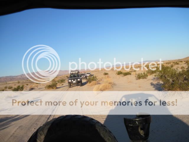
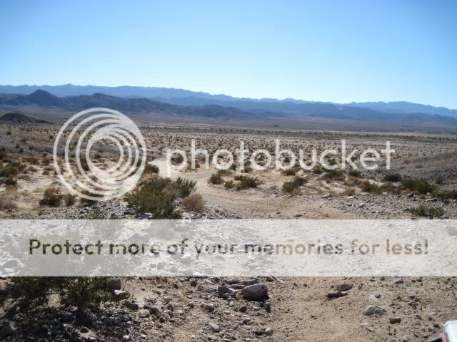
Our run consisted of a variety of terrain. From easy going dirt trails, to whoop-de-doos, twisty mud hill canyons, and sandy washes. No ships in sight yet.


Our run consisted of a variety of terrain. From easy going dirt trails, to whoop-de-doos, twisty mud hill canyons, and sandy washes. No ships in sight yet.

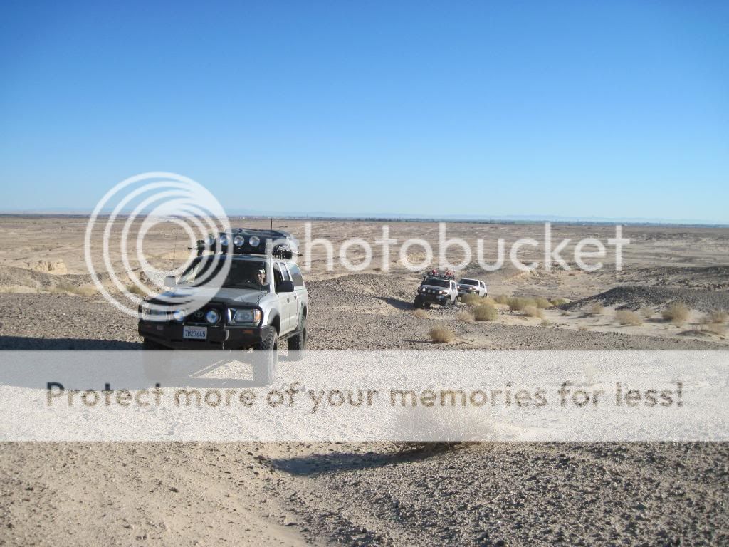
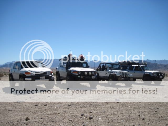
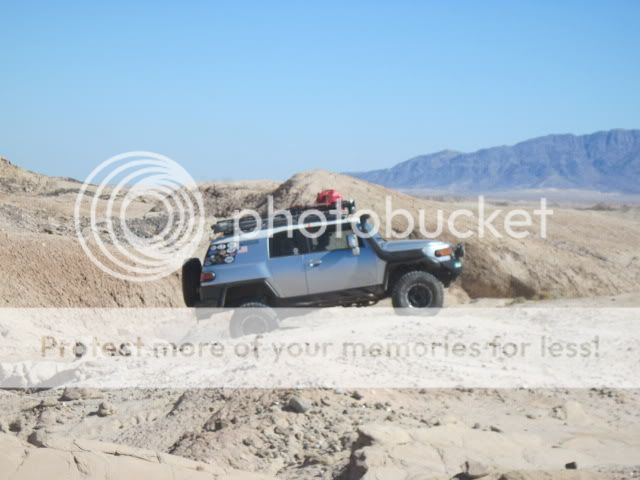
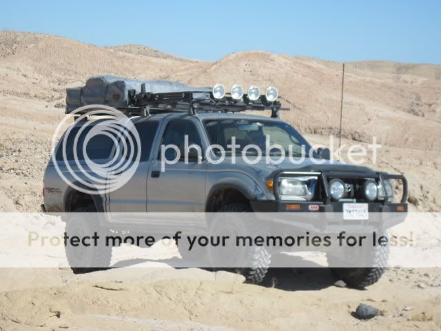
Following closely was two Toyota FJ Cruisers and a Tacoma Double Cab.
There were very few other tracks along much of the sand-blown trails.

Route marker and sign.


Signal Mountain, or El Centinela in the distance, located just beyond the international border.

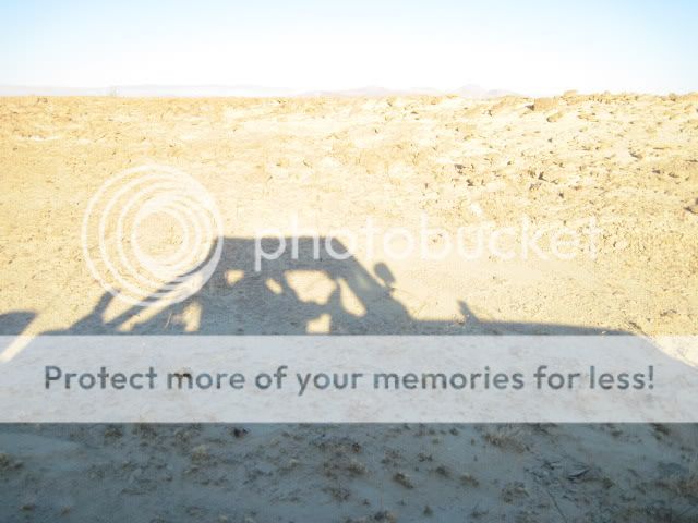
Not much out here right now besides my shadow.
Looks like I still haven't lost my traveling companions.

One of the many wide, sandy washes we find ourselves in. Time to put the hammer down!

At this point, there's no doubt that we're lost. However, I know to just keep heading south.
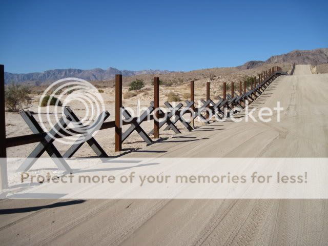
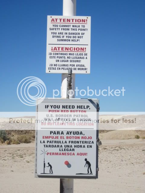
Crossing Highway 98 we continue onwards towards Mexico. Situated along the Californian-Mexican border, the U.S. Border Patrol has a strong presence in the area. I lost count on how many patrol trucks we passed along the trails. In the picture below you can see how they smooth out the edges of the trails to detect any foot traffic coming through. We were nice and stayed in the middle of the trail.

Looking south into Mexico at Cerro Colorado. Much of these dune-covered mountains contain excellent samples of fossilized wood.

U.S./Mexican Border at Pinto Wash.
I can remember the border being a dirt trail with a tall boundary marker posted every quarter mile or so. A lot has changed around here.

Looking north into Pinto Wash and Yuha Desert.

Southwest view.

Taking in the views for a bit after a Border Patrol agent checked up on us. "Is this a response to failed government action?" We got a kick out of that one!
Great views but not much room for a lunch stop.

This is much better!

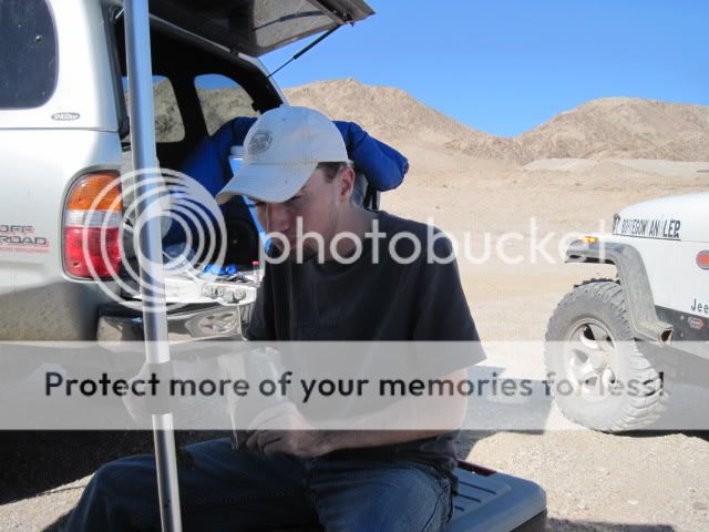
Derek enjoying his MRE.
Ralphie and Willie kickin' back.

I was sure to bring sandwiches and water. It was great relaxing under the shade of Ralphie's awning.
Everyone had fun shooting my Walther P22 and .357 Lever-Action Marlin.


After lunch, we continued North across Highway 98 and picked our way along the Historic Anza Trail.
Imagine traveling through this region hundreds of years ago either by foot, horseback, or wagon.

The Anza Monument overlooking the Yuha Wash and well.
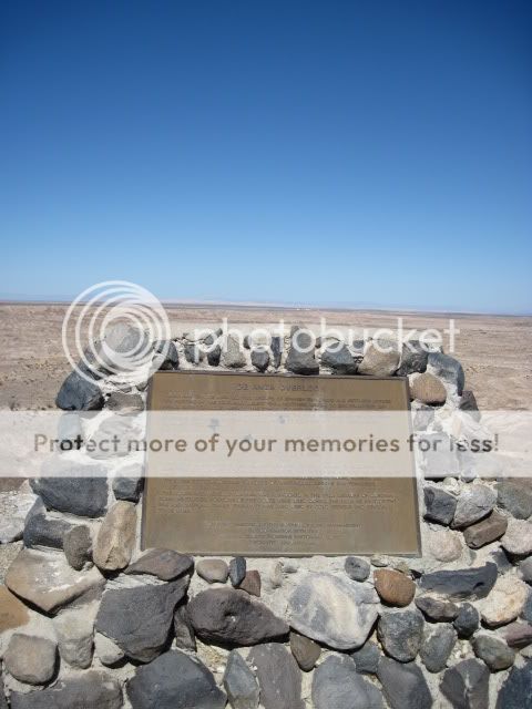
It reads: "Juan Bautista de Anza led two groups of Spanish explorers and settlers across this portion of the Colorado Desert from northern Mexico to San Francisco Bay. During each tortuous passage, the Spanish camped below here in Yuha Wash. The passage in 1774, whicj explored and pioneered the first overland route into upper California, consisted of only a small group of soldiers and two missionaries, Fathers Garces and Diaz.
A second trip in 1776 brought settlers to the coast of California. Spain felt that its tenuous hold on the New World was threatened by Russian settlements to the north. The Spanish missions were struggling to survive and needed a reliable supply route to ensure military, political, and religious success.
This expedition contained 240 people, including Captain de Anza, 38 soldiers, 16 muleteers, 136 colonist, several Indian guides, and Father Pedro Font, as chronicler. There were over 800 head of livestock which included pack mules, horses, and cattle. The settlers became founders of what would become San Francisco.
The route discovered by de Anza was abandoned in the 1780's because of Quechan Indian hostilities. Portions of the route were used in the 1800's as part of the Gila and Overland trails. Finally, it was used by gold seekers and several stage lines.
(Monument erected by BLM in cooperation with Imperial County Pioneers Historical Society, dedicated January 1990.)"
Parked at the Yuha Well.

You know there's got to be water here if there's grass growing.

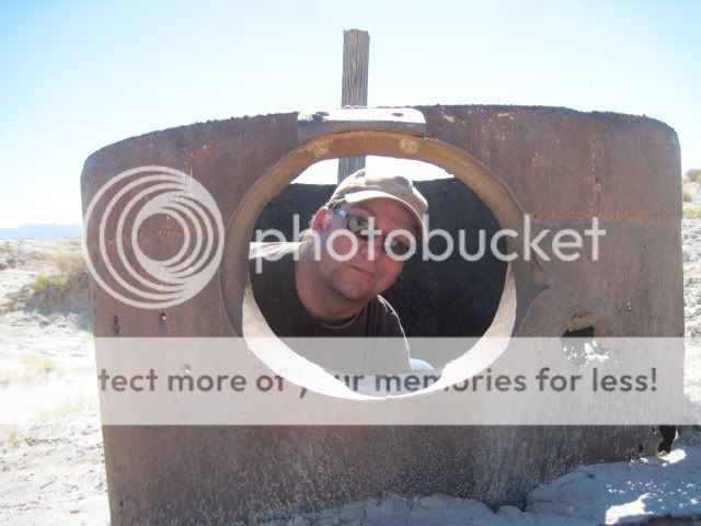
Help! I've fallen into a well!

We continue on and find ourselves lost...
...again.
No worries! We can just push this button and help will be on its way.
Back on track.

So many possibilities on where to go...

We come across several fenced-off sections of land. Its not obvious what they are so we take a closer look.

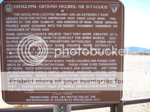
Turns out to be a Yuha Geoglyph which is a large, abstract image created on the desert surface by Native Americans. The geoglyphs serve as a reminder that the desert has been inhabited by people for thousands of years.

The end of our route was in sight. Still no ancient ships but we've undoubtedly come close!
Flooded Ocotillo.
Flooding disrupted transportation routes in the county. Part of Interstate 8 along the San Diego and Imperial County border was washed out. Three trestles belonging to the San Diego and Arizona Eastern Railway were destroyed, and five others were damaged. At more than 50 other locations, tracks were buried by mudslides or had the ground under them washed away. After assessing the damage from Kathleen, the Southern Pacific Transportation Company decided in 1977 to abandon most of the SD&AE railway, but in 1978 the Interstate Commerce Commission disallowed this plan and the railway was restored.
With the BorregoFest prerun now officially over we decided to head further north to check out a few other trails in the area. The first stop was Devil's Canyon and then the old Dos Cabezas Railroad Station. Having been closed to vehicular travel since 2007, the historic route through the canyon was now open for use via permit. There's actually no signs showing you how far your allowed to drive up the canyon without a permit but there is a large boulder planted square in the middle of the trail, probably due to all the recent earthquake activity in the area.

Dos Cabezas Siding, the final stop on the San Diego & Arizona Eastern Railroad before entering the rugged Carrizo Gorge.

Now this would usually be the end of the trip report with thanks to all who came along and helped out, however things didn't end as smoothly as usual. Once on the street I noticed a strange noise coming from the front of the Jeep, then I suddenly had to fight the wheel as it started pulling to the right side of the road. Pulled over, got out and checked all the steering components, brakes, drive-train, suspension, etc. Nothing was leaking or looked out of place. Got to the gas station and check over everything again. Nothing. Well, I decided to just take it slow on the freeway but as the symptoms go worse I figured it was better to play it safe than sorry. So after parking in Jacumba and unloading all my gear into Derek's truck, he gave me a lift home. Both he and Ralphie were a big help to me when things started going wrong and I'm very thankful.
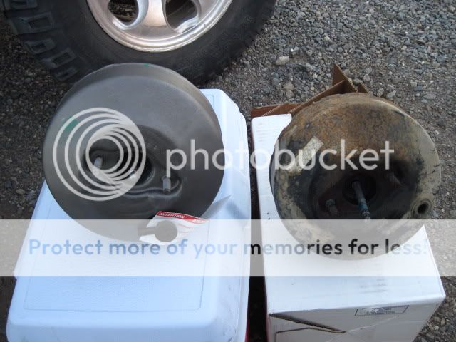
The next day after discussing the situation with my father in-law, who also happens to be a very handy mechanic, we picked up a new brake booster and headed out.

New and old. Hope this works!
It didn't...

Towed home in shame!
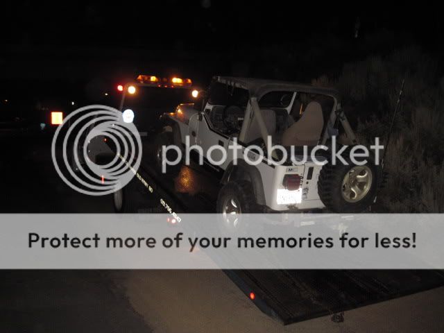
It looks like I may have busted the front axle, as the wheel started walking out of the housing. I'll update more when I'm able to get a good look at things in the daylight. At least something broke at the end of the run rather than ruining our fun in the beginning!
Update:
It turns out I blew up my front passenger hub assembly real good, so I picked up a new one along with a good used axle shaft and had it all back together in no time!


Update:
It turns out I blew up my front passenger hub assembly real good, so I picked up a new one along with a good used axle shaft and had it all back together in no time!


Ready to hit the trails once again!