Thursday, May 24, 2012

Anza Borrego: Box Canyon Historical Trail


I decided to make a quick stop at the Box Canyon monument and overlook along Highway S2 as I drove through Anza-Borrego Desert State Park. This has been one of many things on my list to see. I still need to head back sometime and hike down into the canyon. There's much history here. The Southern Emigrant Trail, the Mormon Battalion, and the Butterfield Overland Mail Route used this low mountain pass.

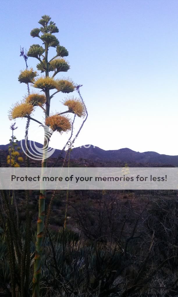
A distant fire in Mexico made for a hazy day.

A quick stop near the small desert town of Ocotillo. I saw no snakes.

The Century Plants were in abundance here.

These misnamed plants actually only live 10 to 30 years.


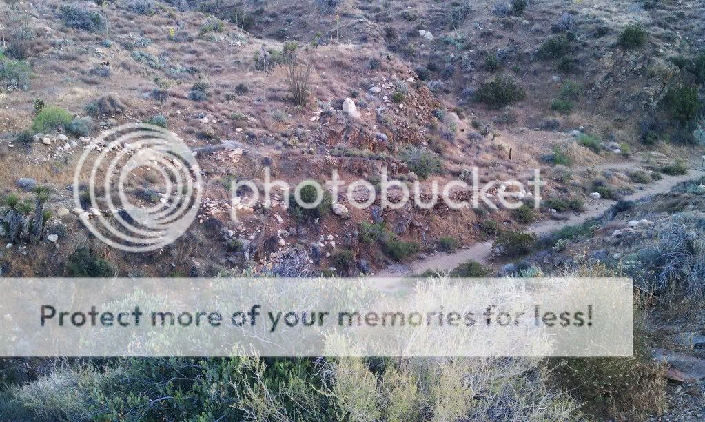
View from the overlook. The Mormon route is the upper trail while the Immigrant and Overland Mail Route is down in the wash.

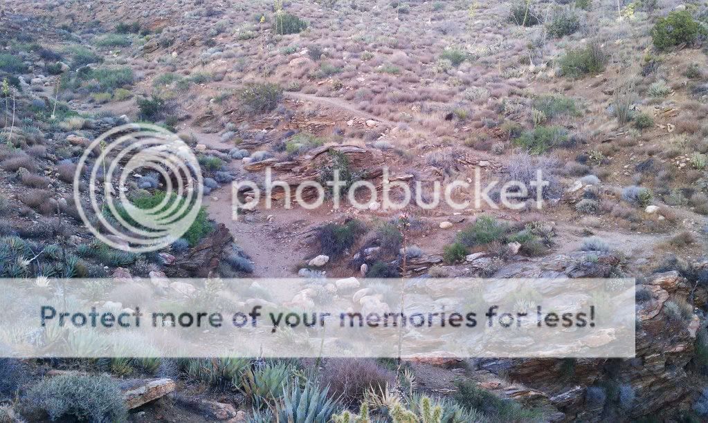
The historical marker is right by the highway; the overlook of the trail below is 250 feet farther east. By following the path down to the trail itself, you quickly get a feeling for the obstacle that this rocky ridge represented for early travelers.

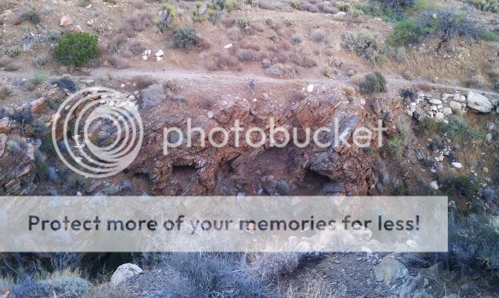
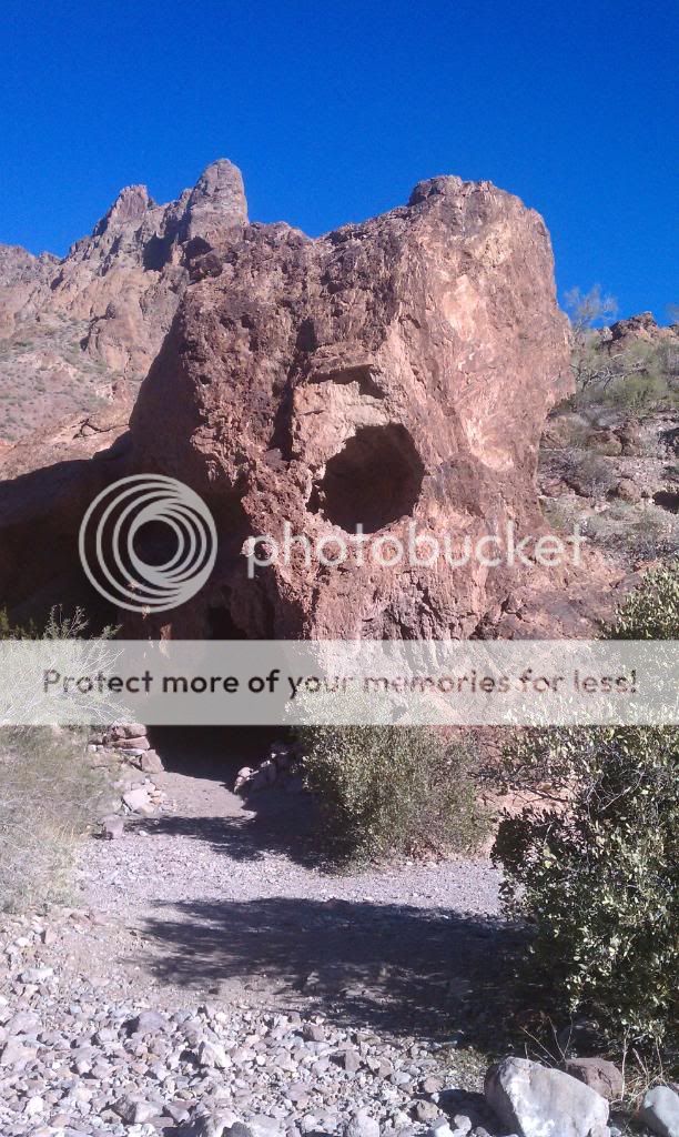
In 1847 the Mormon Battalion cut a detour around the box canyon; traces of its efforts are visible on the canyon walls. To follow a piece of the trail itself, follow the sloping trail down to the right to a wooden post marked “U.S. Mormon Battalion Trail.” At this point, the trail coincides with the wash. The historic wash trail is marked with an occasional wooden post. 
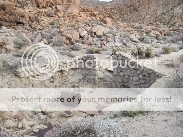
Your hike parallels the highway but is wholly hidden in the small canyon to provide a feeling of seclusion and communion with the hundreds of previous users of this trail segment.

Tuesday, May 22, 2012

SoCal & AZ Overland Adventure Dec. 2011 Part IV


Day 4: Kofa National Wildlife Refuge & Trip's End


For 57 miles, US 95 cuts through the desert of Southwest Arizona - quite flat, perfectly straight and aligned exactly north-south, and interrupted only by the small town of Quartzsite. In the mild seasons of winter and early spring, much traffic uses the road, bringing sun seekers from all over the US to Yuma and on into Mexico, but few travel to this region in summer, when temperatures of over 120°F are not uncommon. Rain falls on only a few occasions each year - the summer thunderstorms that affect the higher areas of Arizona rarely extend this far. South of Interstate 10, US 95 is bordered by the Yuma Proving Ground to the west and the Kofa National Wildlife Refuge to the east - a protected area 25 x 40 miles in extent with no paved roads or facilities of any kind. The refuge is an excellent place for viewing desert plants and wildlife, rock climbing, exploring old mines, or just camping in remote wilderness.

Morning along Palm Canyon Road.

Signal Peak in the distance.

It was really cold out!

Our campsite.


This graded dirt road provides access to Palm Canyon, from where a short hike leads to views over what is possibly the only community of native palms in Arizona. The trail itself is suitable for passenger vehicles. This area has sweeping views west over the La Posa Plain to the Trigo Mountains and Chocolate Mountains and is especially lovely at sunset. The California palm fans, from which the canyon derives its name, are thought to be remnants from an era when Arizona was a lot cooler and wetter than it currently is. The cooler air within the canyon, lack of direct sunlight, and slightly moist conditions have allowed the trees to survive. The hiking trail to view the palms is a rough but well defined path that climbs up into the canyon for half a mile to a viewing point.

Start of the hiking trail.

California Palm Fans.

Looking back down the canyon.

Now on our way to Kofa Queen Canyon.


This spur trail is one of the few within the Kofa NWR that travels up one of the high walled red canyons that penetrate into the rugged Kofa Range. After leading off from Palm Canyon Road, the trail is smooth and easy going for the first 4 miles. At 4.3 miles is a large flat area good for camping. At the mouth of the canyon the trail drops into a gravelly wash and remains in it until the end of the route. Big horn sheep like the habitat within the canyon and can often be seen in the early morning and evening high up on the canyon walls. The wash is generally loose and gravelly, with only a few rough boulders to contend with. The last mile, however, is quite brushy, and most vehicles will collect a few scratches.


Aptly named Skull Rock.

End of the line.


On our way back out.


By the time we had finished up here it was already 11AM. I had to work that night so we had to skip the trail through the Castle Dome Mountains. I'll save that for another day. After airing up and parting ways with Steve and Shellie, I hit the road and made it home around 3:30PM. It was a great trip and I look forward to exploring more of this area.


Sunday, May 20, 2012

Anza Borrego - Carrizo Gorge Rail Road Camp - Petrified Wood Hunting


I decided to take a short notice trip out to the desert to check out an abandoned railroad camp in the southern end of the park. The ruins were built to support the construction of the San Diego & Eastern Arizona Railroad through Carrizo Gorge. One wall of the camp still standing is constructed of old rusty blasting powder cans and mortar. Afterwards, I headed out east of Carrizo Mountain to look for petrified wood. On the way home I stopped to check out a few sections of the old concrete highway 80 built in the 30's and the old stage coach trail in Devils Canyon. It was nice to get out.

Start of the trail off Highway S2, East of Ocotillo.

Use caution around this info board. There's a large bee hive under the awning.

The beginning of the trail is easy but it gets rockier.

Into the desert.

I found the old workers camp.


More ruins closer to the tracks.

I made a short stop to one of the many tunnels. 

On my way out. 


There's an old indian camp near here. I'll have to hike back there someday.

There was a group of mountain bikers getting ready to ride the tracks here.


At this point I've left State Park land and headed into the adjacent Yuha Desert.

On Old Highway 80 heading towards Ocotillo.

You don't want to drive too fast along this old road...

My hunting grounds.

I got wood!


New power lines.

There are large hills of fossilized reefs and shellfish throughout the area.

A section of Old Hwy 80 off Mountain Springs overlooking I-8.

This is a good spot to stop and hike the surrounding areas.

Hike down this slope, under the freeway and up the wash to find an old stone cabin.

Some of the petrified wood pieces I found.