
There are two deserts. One is a grim desolate wasteland. It is the home of venomous reptiles and stinging insects, of vicious thorn-covered plants and trees and unbearable heat, visualized by the children of luxury to whom any environment is intolerable which does not provide all the comforts and luxuries of a pampered civilization.
The other desert-the real desert-is not for the eyes of the superficial observer or the fearful soul of the cynic. It is a land which reveals its true character only to those who come with courage, tolerance, and understanding. For those the desert holds rare gifts.
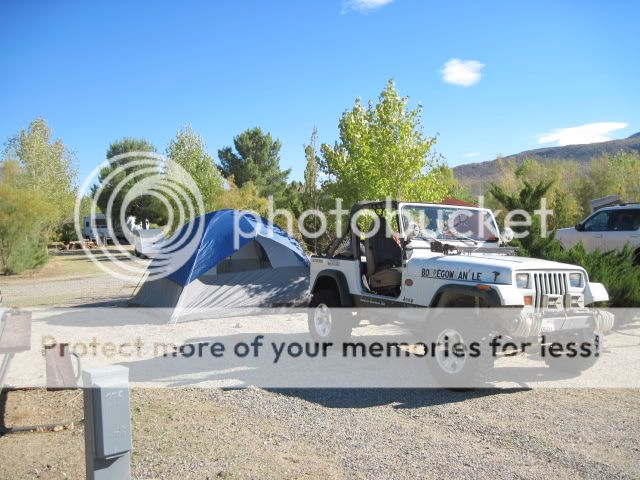
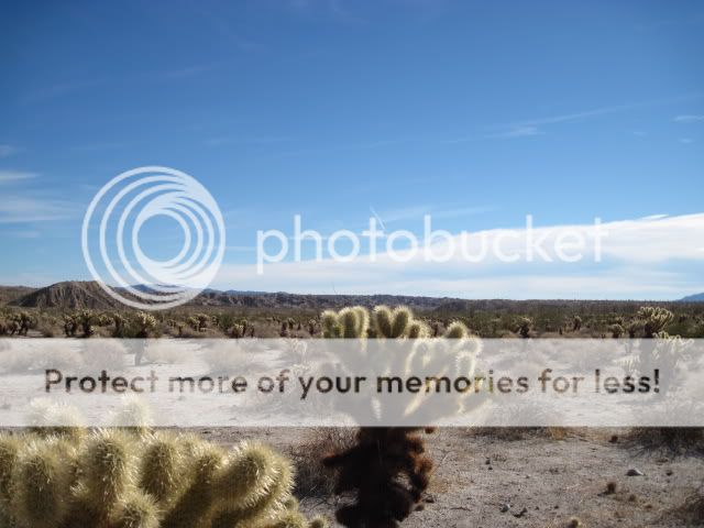
It was an incredible weekend of trails, camping, and food for this year’s BorregoFest event, put on by Outdoor Adventure USA, in Southern California's Anza-Borrego Desert State Park from October 22-24th, 2010. This is an annual event open to the public who are members of the online forum. The base of operations for the event is the Stagecoach Trails Campground. (7878 Great Southern Overland Stage Route of 1849 Julian, CA 92036) Trail runs were held for Coyote Canyon and Font's Point, Truckhaven, a Julian Mine tour, Painted Gorge/Carrizo Mountain and the Yuha Desert (Lost Ship of Pearls run).
On Friday I arrived later than planned (I'll have a new post about that) and set off on my own to do some recon on some of the routes we'd be traversing the next day. Over the past few days a fairly large storm had moved through and I wanted to check on the conditions of the trails. My trip down Pinyon Mountain Road would take me into Fish Creek and through Split Mountain.
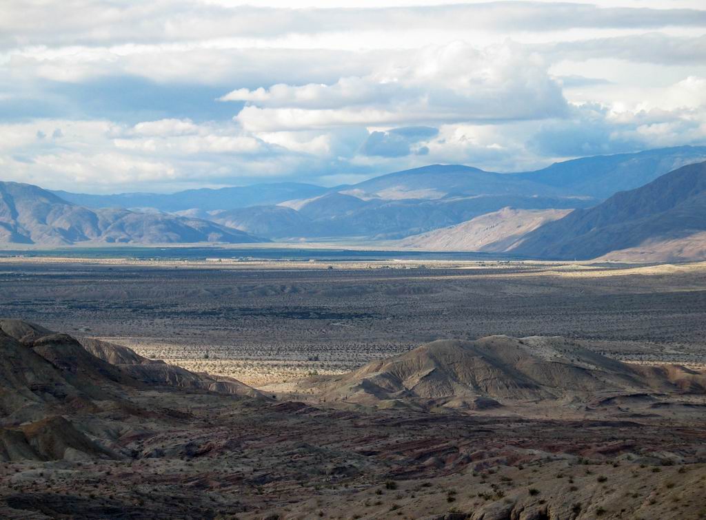
Looking out over the valley where we're camped.

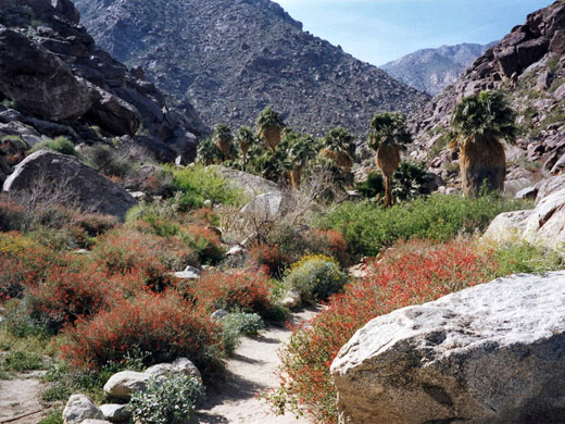
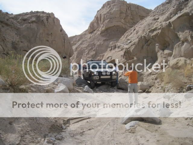
The Squeeze on Pinyon Mountain Road.

Painted Gorge / Carrizo Mountain
Painted Gorge gets its name from the colored sections of red, blue, and green sandstone blocks within the gorge. The begining of the trail passes through Plaster City OHV Area into a wide open area. The graded road soon becomes a trail as it nears the sandy wash of Painted Gorge and quickly enters the canyon. Embedded rocks litter the wash, which eventually turns into a very narrow, rocky, loose shelf road as it nears the summit of Carrizo Mountain. There are great views of the Yuha Desert, Salton Sea, and colorful shapes of the Carrizo Badlands along these old mining trails.
Overview of the route.
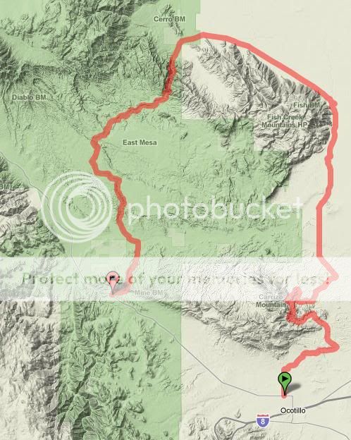
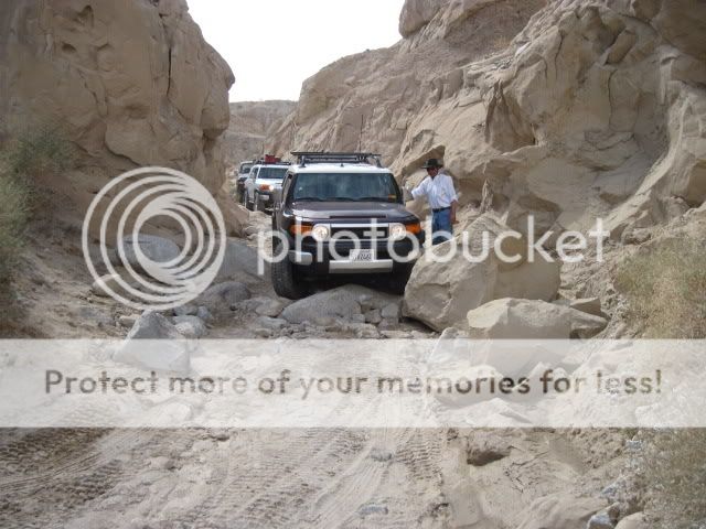
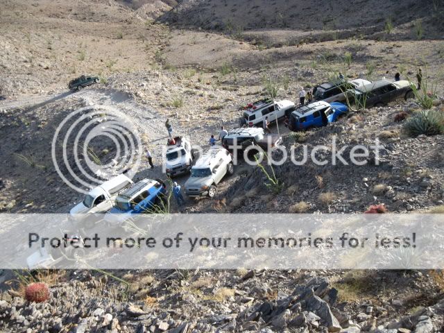
Since we had such a large group signed up for this run we split it into two runs. My group would leave the pavement at Vallecito Wash from highway S2. From there it was onto Arroyo Seco del Diablo (Spanish for "Devil's Dry Wash"), down Diablo Drop Off into Fish Creek and through Split Mountain. Heading east past the gypsum quarry along the rail road tracks took us through BLM land and around the Fish Creek Mountains, past Plaster City and onto Painted Gorge Road, just off Evan Hewes Highway (S80). The other group ran that route in the opposite direction.
Route up Carrizo Mountain.

Airing down at the trail head.

For thousands of years, the course of Vallecito Wash has been a refuge and trail for many native and immigrant Americans. Generations of Kumeyaay people camped along the springs here. The Mormon Battalion of 1847 passed here to join in the war between the Untied States and Mexico. This wash also follows a section of the 2,800 mile-long Butterfield Overland Stage route between St. Louis and San Francisco. The route operated from 1857 to 1861.
Butterfield Overland Stage Route


From wagons to 4wheel drive vehicles, Vallecito Wash has seen many a traveler.

From Valliceto Wash we turned north into the twisting canyon of Arroyo Seco del Diablo (Spanish for "Devil's Dry Wash). Here in the midst of the Carrizo Badlands, we find ourselves on part of an ancient alluvial fan from the ancestral Colorado River, which emptied into the Gulf of California as a delta outlet. Arroyo Seco del Diablo has cut through the hardened sandstone concretions carried downstream from afar to create the deep-sided canyon this trail follows today.
Stopping to check out trail conditions ahead.

The loose and fragile walls of the canyon mean that rock and sand falls are common. Flooding through these areas compounds the problem for vehicles trying to make their way through.

Let's go for it!

Its getting a little tighter...

Once out of the trench and onto the trail I promptly sank into the deep mud.
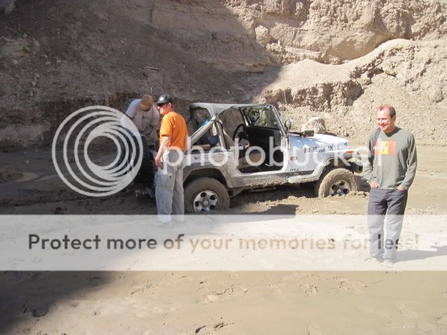

After a few tries, I had the Toyota Land Cruiser behind me pull me out.

Now came the hard part. We had to get out the shovels to break down the bank on the right side of the trail so the vehicles would be able to bypass the muddy section. Since the Land Cruiser was equipped with a locker and bigger tires, I let him around me to find a way through. Here is some of the raw video footage of this part:
We encountered a few more washed out areas but nothing as bad as the first big one we ran into. What was great about this run was that we got to see conditions in the desert here that are not all that common. Its usually very dry and dusty.


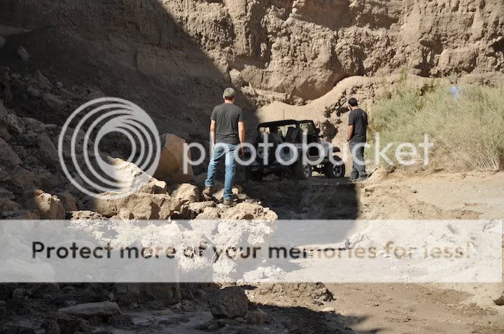
Our next stop was Diablo Drop Off, which would take us through a narrow canyon and into Fish Creek. The drop-off is made up of two descents with a break in the middle. The first is steep with loose sand and ruts. The second part is a narrow slot with large steps and wheel ruts.
Below the first drop off.

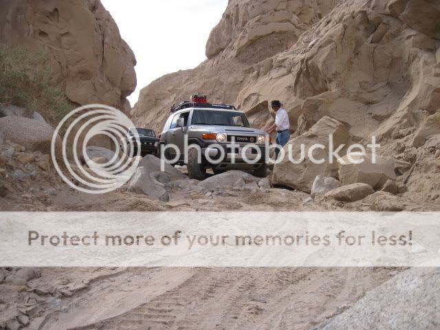
FJ Cruiser coming down the second drop off.

Group shot below Diablo Drop Off.

Coming through the canyon that takes us out to Fish Creek.
This section used to be more difficult. Much has been filled in with sand from flooding.
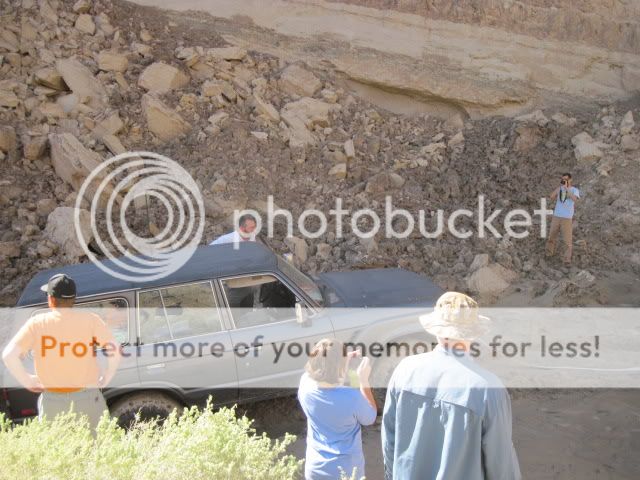
However, we would encounter problems here soon.
Just past this point the Land Cruiser went too far up into the bank and flopped over on the trail.
This just goes to show that you can't take things for granted even on easy trails. A lapse in concentration or getting distracted can cause just such an incident. No one was hurt and after righting the Toyota it was able to complete the trail run.


Fish Creek runs through Split Mountain here.

Railroad trestle over Carrizo Wash.


By now, we're out of the State Park and onto BLM land.

Looking out towards the Carrizo Bombing Range.

Some sort of control or observation tower.

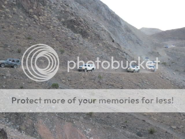
Passing the other group on our way to Carrizo Mountain.
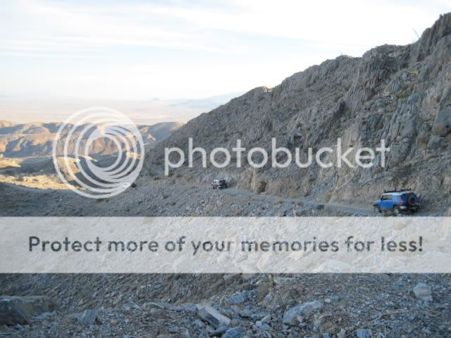
Climbing the shelf roads.

Parked at the summit.

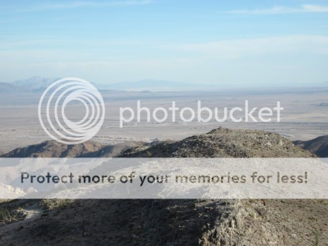
Views from the top.


Heading back down.

Coming down into Plaster City OHV Area.

From here it was a short drive out to the highway to hit the gas station and then about 40 miles back to camp.

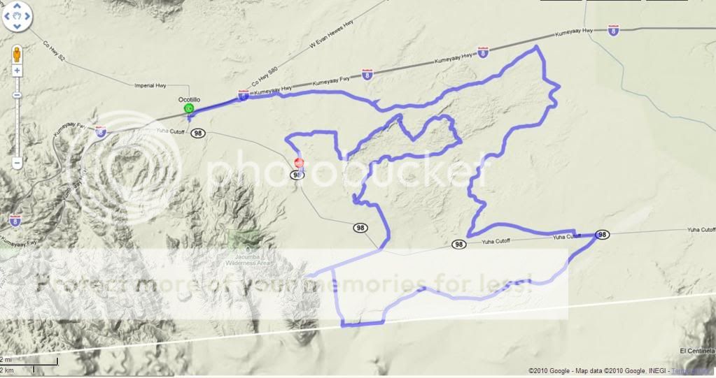
Lost Ship of Pearls (Yuha Desert) Run
For those who may not be acquainted with the legend, somewhere admits the desolate landscape of the Yuha Desert, may rest an ancient ocean-going vessel.
In 1610, King Phillip III of Spain ordered Alvarez de Cordone to search the Western coast of Mexico and recover the pearls residing there. Cordone hired two other captains, sixty pearl divers and began having three ships build. By July 1612 they set sail to plunder the west coast of its precious oysters.
Along the way, Cordone, having been injured in a conflict with local natives, was forced to turn around. But not before ordering the other two ships to continue North up the coast. Eventually the cargo of both ships was transferred into the hold of just one when one of the two ran aground of a reef. With one ship remaining they sailed up the Gulf and eventually up the Colorado River and into the Salton Sea or Lake Cahuilla, which was six times the size of the present Salton Sea.

Now there are many speculations as to the exact conditions and size of this ancient inland sea and exactly who’s ship was here. Regardless, when whatever Spanish ship had sailed into this area, turned around to try and head back home, they were dismayed to find that it was closed off. With the outlet to the ocean blocked, the water slowly receded and eventually the ship was beached on the California desert, many many miles from the ocean. The ship was abandoned and four months later the survivors were finally rescued.
Over the years this story has persisted, as told by native Americans, immigrants, and prospectors. Our Sunday run into the unknown may not have been a success as far as uncovering the truth of this legend, but we did find adventure and explored the much unseen beauty and wonder this area has to offer.
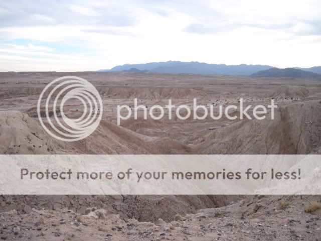
The Yuha Desert of extreme Southern California is rich in both human and natural history. The area contains several unique attractions; the Juan Bautista de Anza National Historic Trail, geoglyphs created by Native Americans, an area of rare crucifixion thorns, oyster shell beds, and the Yuha Well. The Yuha Desert is an Area of Critical Environmental Concern and is a limited use area. Routes traverse a variety of terrain, from flat desert pavement to sandy washes, to mud hills and other badlands type features.
Much of this area was covered in my prerun which I posted earlier this month here: Lost Ship of Pearls prerun
Our route.
Airing down.

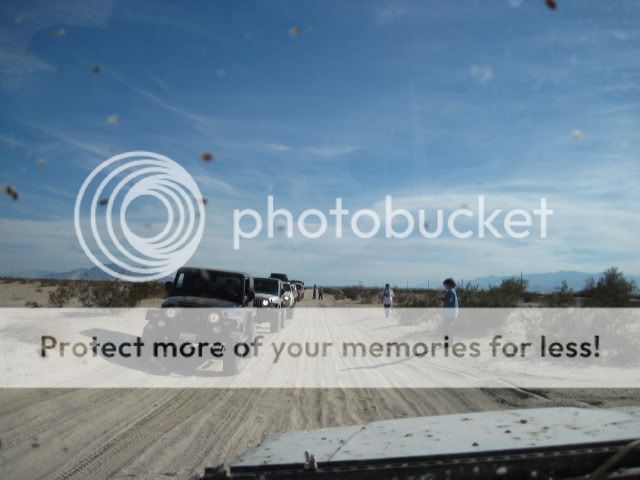
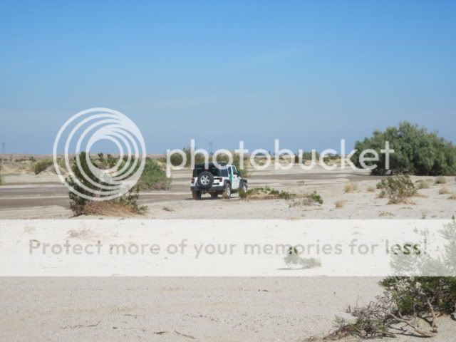
The first part of our route was primarily flat open desert.

Sometimes it seemed as if we were on another planet.


One of the many "immigrant help button towers".

We often found ourselves sliding through many of the still wet and muddy washes.

One of the few Border Patrol agents we encountered.

Looking North above Pinto Wash.

U.S. / Mexican border.

Circled the wagons for lunch.

Getting some range time in.


The group at the Anza Overlook Monument.

"Juan Bautista de Anza led two groups of Spanish explorers and settlers across this portion of the Colorado Desert from northern Mexico to San Francisco Bay. During each tortuous passage, the Spanish camped below here in Yuha Wash. The passage in 1774, whicj explored and pioneered the first overland route into upper California, consisted of only a small group of soldiers and two missionaries, Fathers Garces and Diaz.
A second trip in 1776 brought settlers to the coast of California. Spain felt that its tenuous hold on the New World was threatened by Russian settlements to the north. The Spanish missions were struggling to survive and needed a reliable supply route to ensure military, political, and religious success.
This expedition contained 240 people, including Captain de Anza, 38 soldiers, 16 muleteers, 136 colonist, several Indian guides, and Father Pedro Font, as chronicler. There were over 800 head of livestock which included pack mules, horses, and cattle. The settlers became founders of what would become San Francisco.
The route discovered by de Anza was abandoned in the 1780's because of Quechan Indian hostilities. Portions of the route were used in the 1800's as part of the Gila and Overland trails. Finally, it was used by gold seekers and several stage lines.
(Monument erected by BLM in cooperation with Imperial County Pioneers Historical Society, dedicated January 1990.)"


To view more pictures and the full trip reports for all of OAUSA's 2010 BorregoFest trips click here.
No comments:
Post a Comment